The first full day completed, and followed by some very good rest, we awoke to another very misty morning, which showed promise of being another beautiful day. We thought it would be a perfect day to traverse the valley and reach the top of Mount Baw Baw. However, a rather sluggish start and a leisurely coffee in Yarragon before actually heading off led us to think that maybe we might not achieve that lofty goal. Anyway, we set off heading for Neerim South as our first destination. I had been to this small town some 20 years ago, on a consultancy on which I was engaged, but did not then have time for sight-seeing, so it was as though we were seeing the countryside for the first time. And it was stunning! The rolling hills, covered in brilliant green grass, (even if not that long), with here and there clumps of deciduous trees in their finest autumn colours, all bathed in gentle sunlight, made for a perfect country drive. Traffic was light and we just poodled along like the retired couple we are. We had been told that there was a rail trestle bridge at Noojee that was worth looking at, and our plan, if we had one, was to stop in Neerim South for some lunch and then drive on to Noojee. However, before we reached Neerim, we spotted a sign for a “Trestle Bridge, 300m on left”. Thinking this must be the bridge we had been told about, we dutifully turned left, and found ourselves in the very small parking area for a very small bridge. At first we couldn’t even see the bridge, because it was under the road on which we were standing, and very over-grown with all sorts of vegetation.
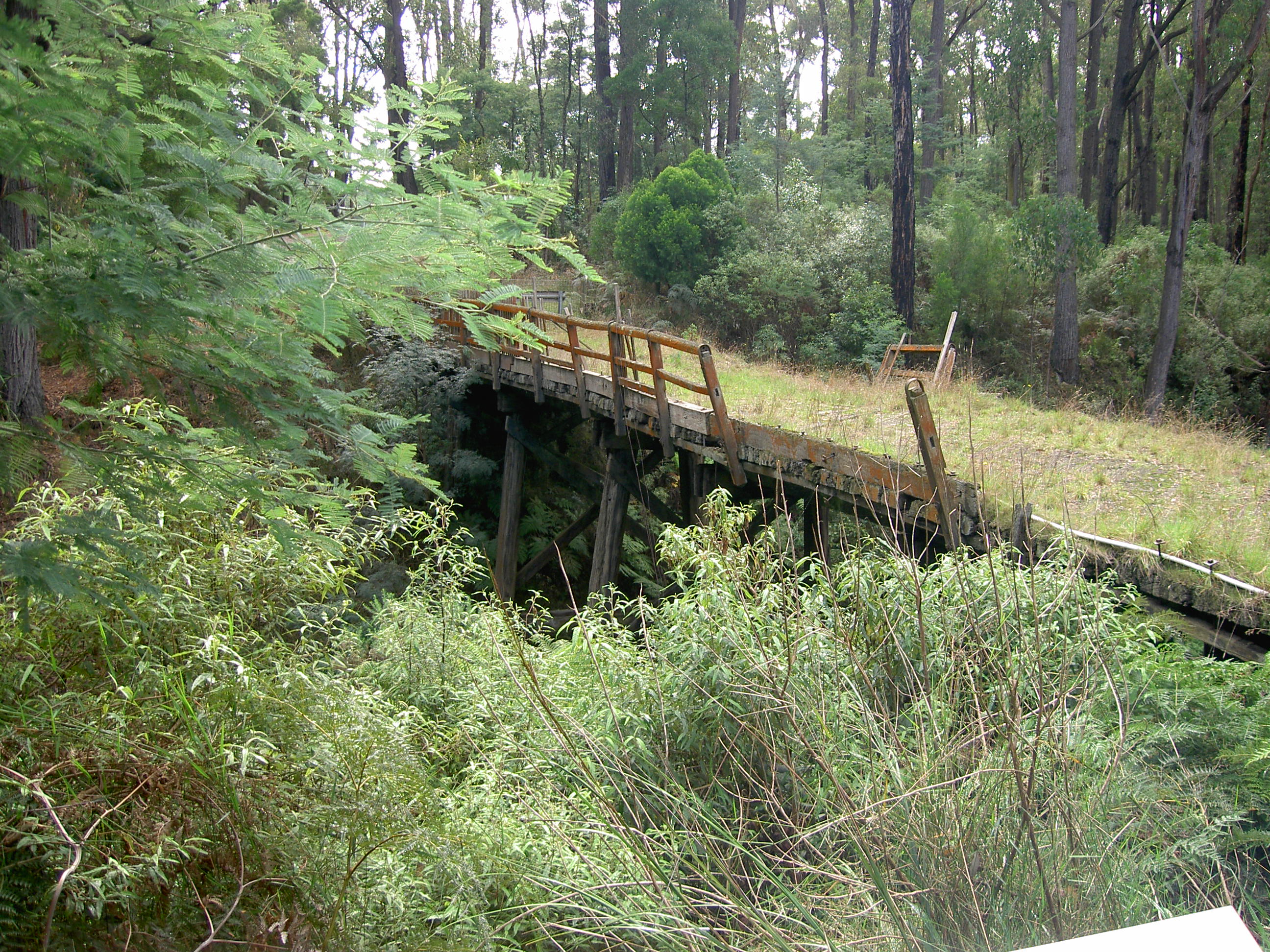
But a signboard in its place soon revealed that this was not the Noojee Bridge, but the Rokeby/ Crossover Bridge, which was closed to road traffic in 2004 after being deemed unsafe. It had been in use as a bridge since the rail cutting was constructed in 1892 as part of the line from Warragul to Neerim, but a re-alignment of the road made it redundant, and it fell into disrepair.
A group of local enthusiasts, the Rokeby and Crossover Friends Group, are raising awareness of the historic importance of this bridge to the local economy and are raising funds with a view to a restoration at some time before it deteriorates too far. Whilst it is a small bridge, the rail network in this part of Victoria was integral to the progress of the local area, and the bridge an essential part of that. So it is a very worthy cause.
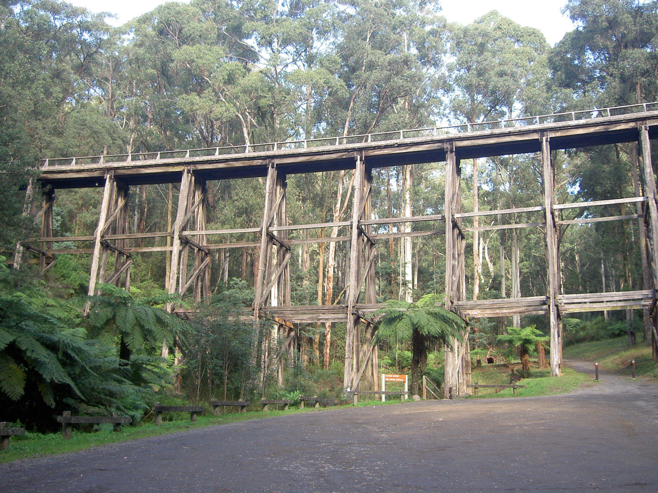
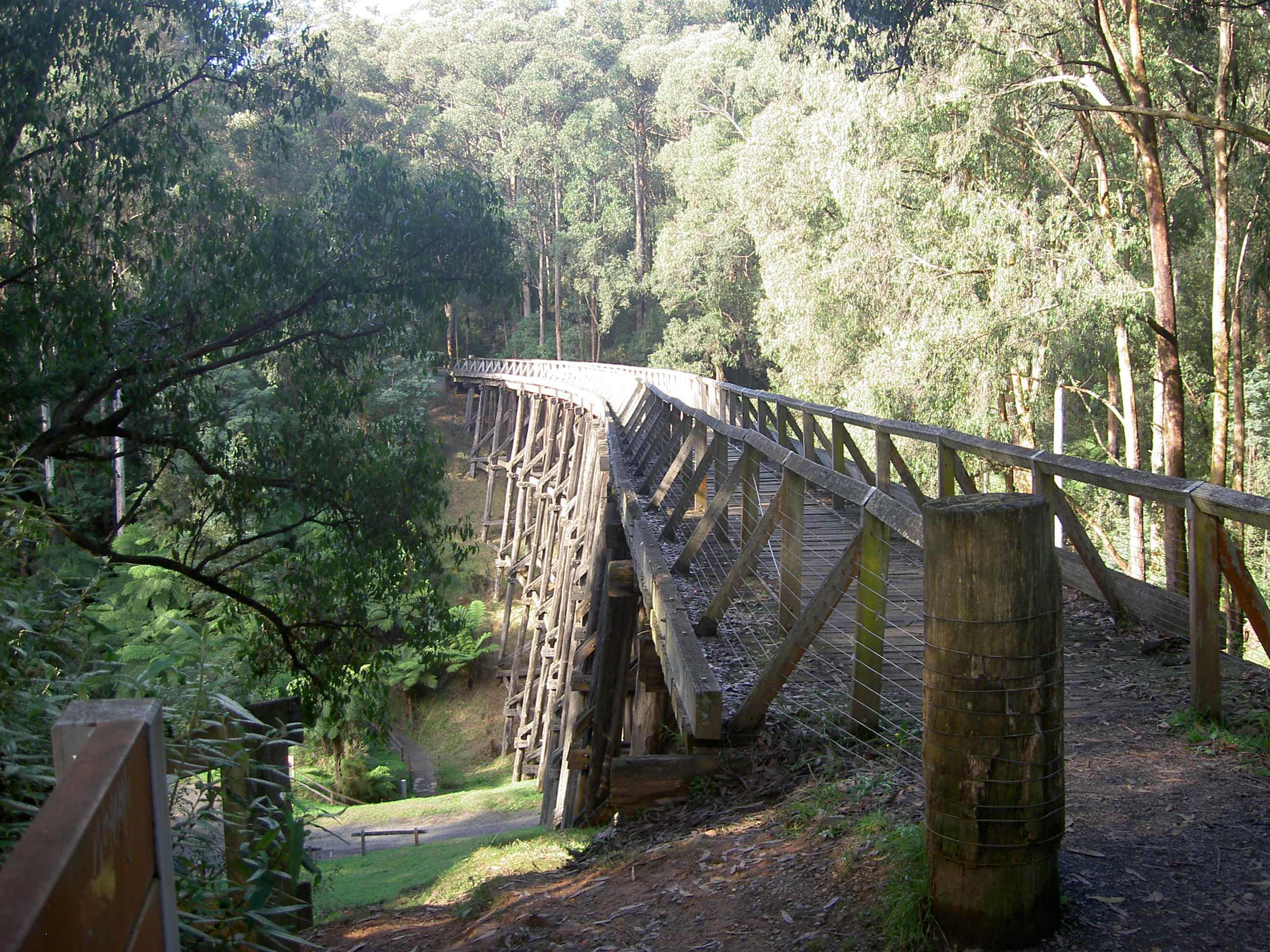
Having stretched our legs taking a short wander through the bush at the bridge site, we moved on to Neerim South, and enjoyed a good coffee and a meat pie in the local bakery/café, before heading off to find the big bridge at Noojee. The drive for this part of our trip was through more rolling pastures, until we met and joined the Mt Baw Baw Tourist Road, where we turned right. A short distance later we passed the Alpine Trout Farm, which unfortunately was closed; a nice trout or two would have made a nice dinner for the evening! So, we continued without stopping, through some bush land and we soon spotted a sign “Historic Bridge, 300m on Right”. Turning into the carpark, we could see the bridge right in front of us—-and it is huge! The photo below shows only one half of the bridge. It would have been great to see an old K-Class steam engine rattling across with half a dozen carriages behind. There were a couple of very good information boards providing all the details of the bridge. It is one of seven bridges on the 46km Warragul – Noojee line, and was constructed between 1917 and 1919 to complete the rail service between those towns. Started in 1889, the line went only as far as Rokeby as its first stage. In 1892, it was extended to Neerim South; in 1917 it was extended to Nayook; and two years later, with the construction of this bridge, it reached Noojee.
At the time, it was one of the largest such bridges in the southern hemisphere.
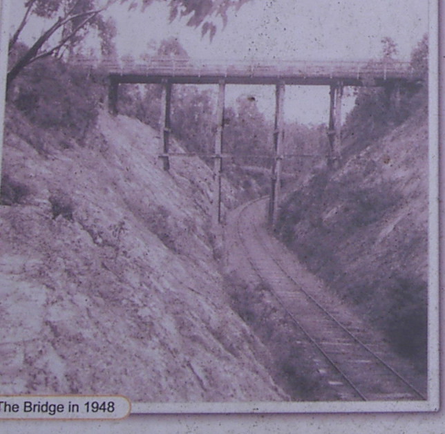
It is 21 metres tall, 107 meters in length, and comprises 19 trestles. At its peak in 1943, there were two trains each day between Noojee and Warragul, travelling at speeds up to 40 kph, with a third available should it be required. However, by 1948 rail services decreased as road transport became more financially viable. A special passenger train ran on March 3, 1954 to take local residents to Warragul for the visit of the recently crowned Queen Elizabeth ll, but three weeks later, one of the bridges was damaged by fire, and the Nayook to Noojee section of the line, which included this bridge, was closed. The rest of the line, from Warragul to Nayook continued in service until being closed in 1958. Between 1959 and 1961 the infrastructure of the rail line was removed except this bridge, which the Buln Buln Shire purchased for £1. As no maintenance was carried out on the bridge for several years, it deteriorated to the point where it had to be closed even to pedestrian traffic. However, in the 1990’s a report recommended some structural reinforcements, which were implemented, and by late 1996, it had been restored to its former glory as a reminder of its importance to the area. It has since become a major tourist attraction, and some 10,000 people visit each year. It hosts an annual “Longest Lunch” and is frequently used as a venue for weddings and other celebrations. If you find yourself in the region, it is very worthwhile making a detour to see it.
It is interesting to note that whilst the car park was empty when we arrived, within about 5 minutes four more had arrived. Chatting with the occupants of one, we discovered that they had driven from Melbourne for the very purpose of visiting the bridge. It was even more interesting to find that they live less than half a kilometre from where we live!
After enjoying a steep climb up to the rail-trail, and across the bridge, we continued on our way to Noojee.
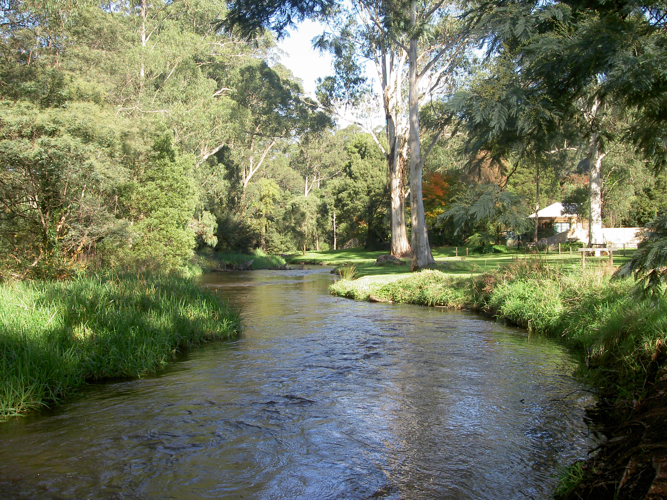
Arrived at Noojee, we found it to be a delightful village, on the banks of the La Trobe River. It comprises a few houses, sufficient to accommodate the population of 170 or so residents, a café, a pub and a few accommodation establishments. There is also a Heritage Centre at the site of the original rail terminus, which has quite a lot of railway equipment and memorabilia, but we had strolled too long around the area of the river, and it was closed by the time we got there! The river itself is very picturesque as it flows through a nice park in the centre of the village. First settled in the 1880s following the discovery of gold in the area, it became a major timber town when the railway arrived in 1919, as previously mentioned. The town was destroyed by fire in 1926, and again in the Black Friday fires of 1939. The only building left standing after the fires was the pub, which served as an emergency community meeting point during the fires, and as the school after the one-room school was destroyed.
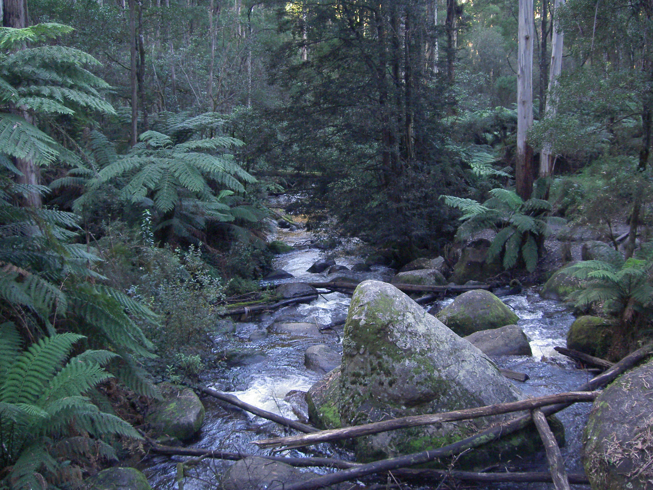
At this point, we realised we definitely would not make it to the top of Mt Baw Baw, so we turned our wheels in the direction of Yarragon once more, not returning by the way we had come, but by continuing with the intention of joining the Fumina/Trafalgar Road. We were not far out of Noojee when we spotted a sign to Toorongo Falls, which of course we could not resist. It was a very pleasant drive, but much further than we thought it might have been. However, after going so far, we had to continue to the end—which turned out to be a further 10minute steep, rocky climb to a point where the falls might actually be visible. But, having left Ann in the car, I decided that the rapids I could see would suffice on the occasion. Maybe next time, we shall make sure we have more time available, and make it all the way!
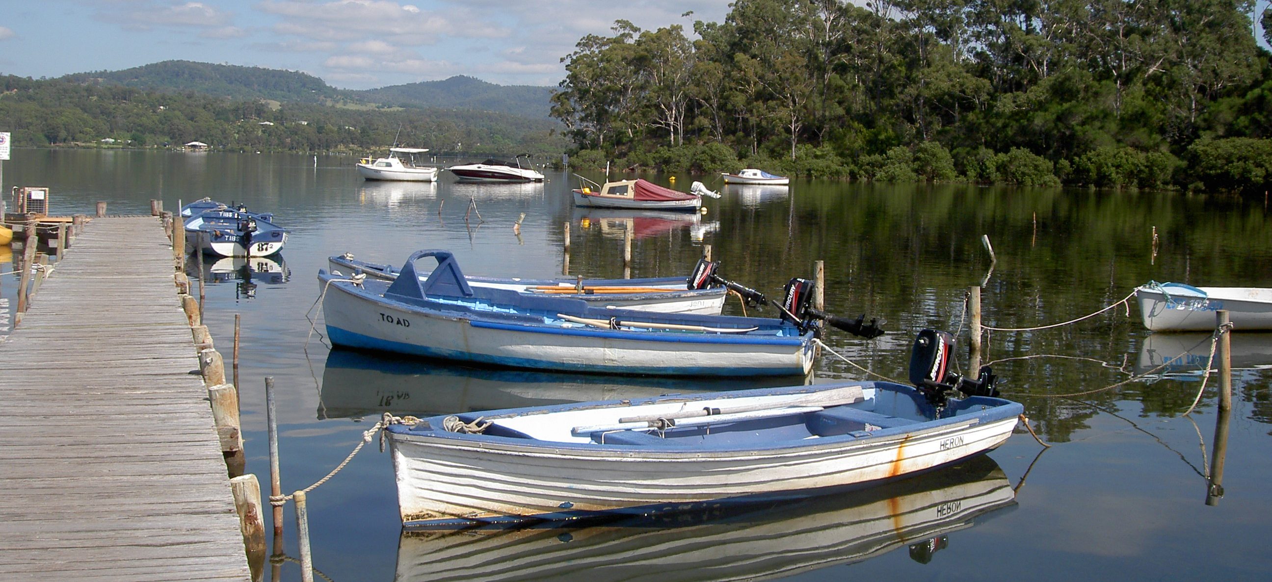
Having ‘done’ the Tooronga Falls, we again set off for Yarragon, by way of Tafalgar. I actually used the ‘sat nav’ for this stage, as we were running out of time, and did not want to go astray. The drive was essentially downhill most of the way, through timber land re-generated following the bush fires and the harvesting of timber. And it was a very pleasant, but very winding, drive. Eventually we reached the open rolling pastures again, driving through Fumina, Hill End and approaching Willow Grove. And it was here that we spotted a large body of water off to our left, which tuned out to be Blue Rock Lake, and a very pretty place it was too!
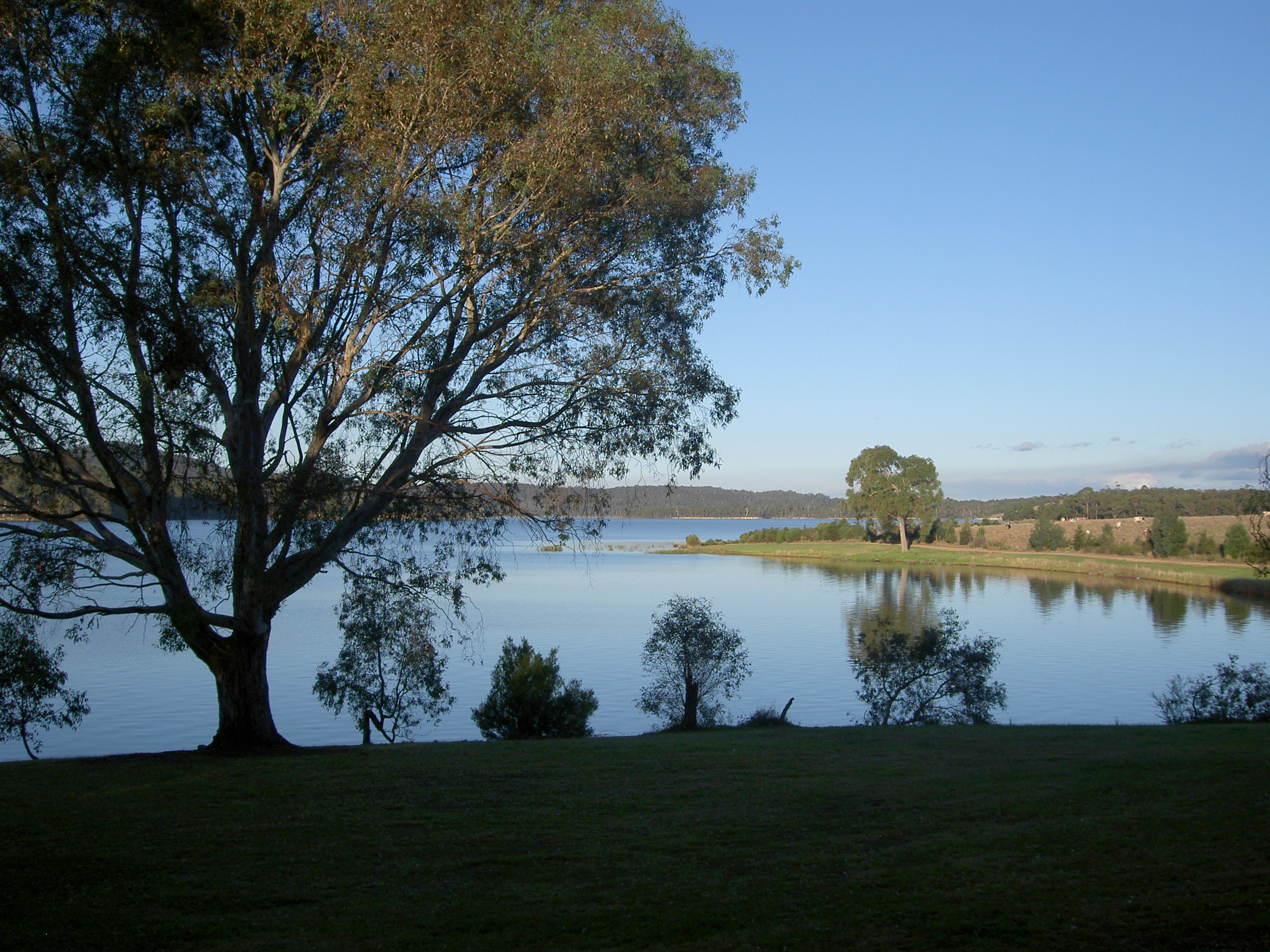
Sign boards indicate that fishing and boating are permitted, but on this day, fortunately all was peace and tranquility. As Darryl Kerrigan would have said, had he been here rather than at Eildon “just look at the serenity”! I had seen signs to Blue Rock Lake in the past but had not known it was such a lovely place!
Back in the car, it was a short trip back to Yarragon by way of Trafalgar at the end of a lovely day out.
