Sketches Of Inverloch


December 2-4, 2016

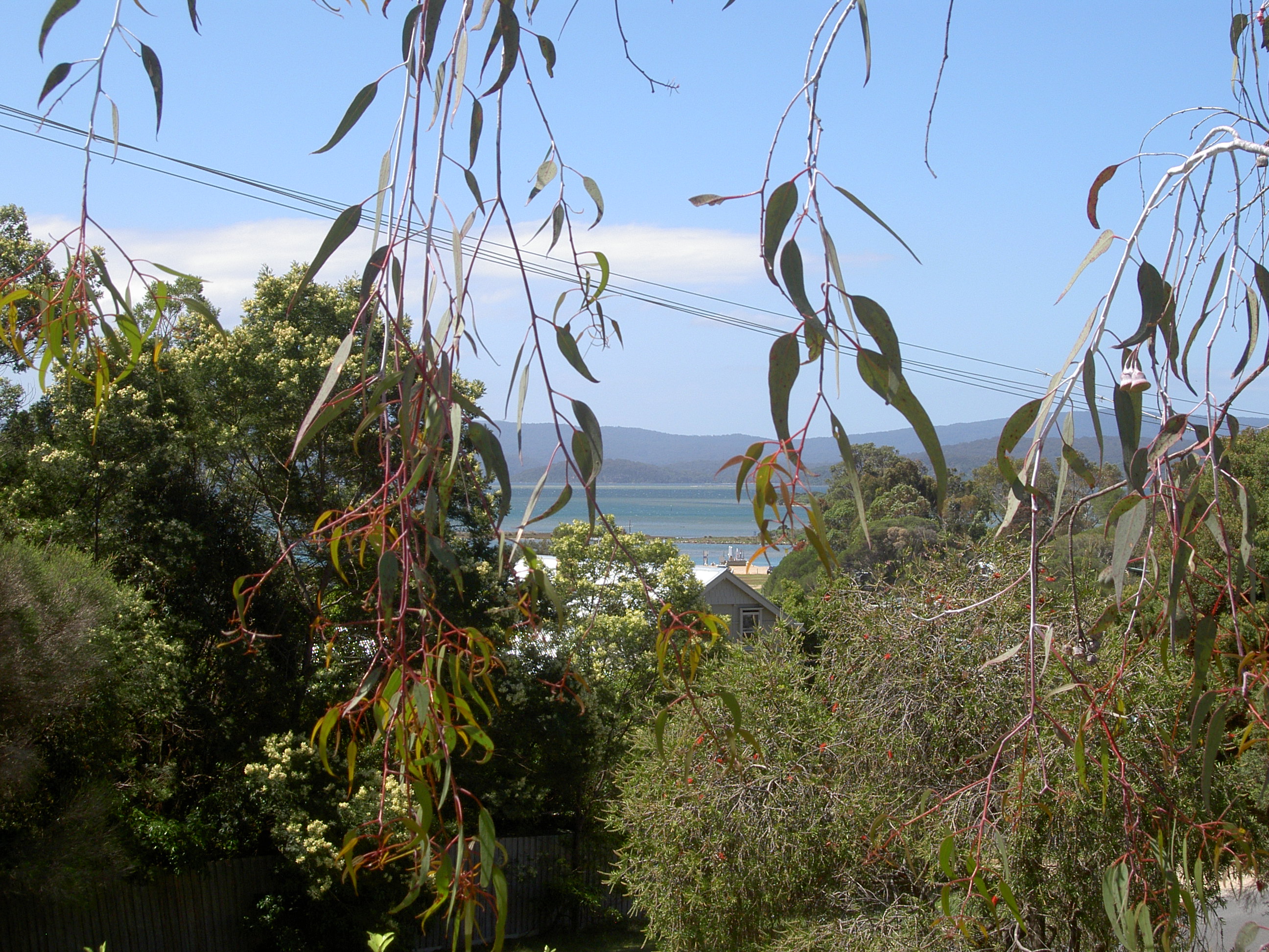
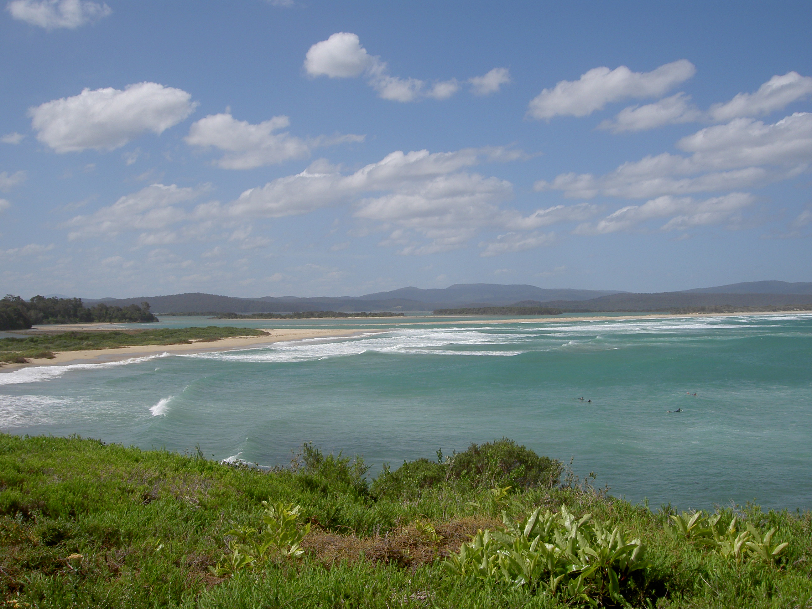
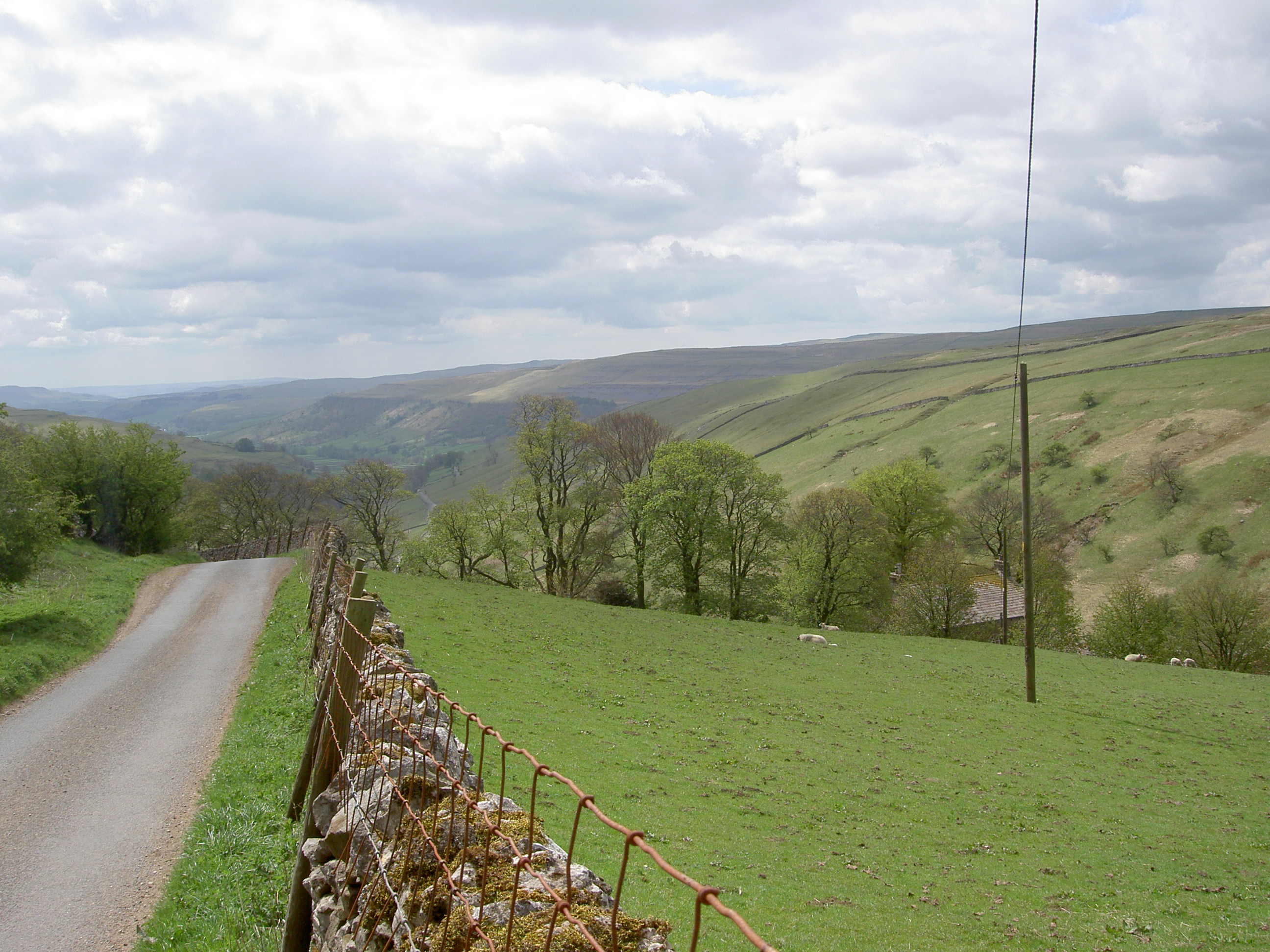
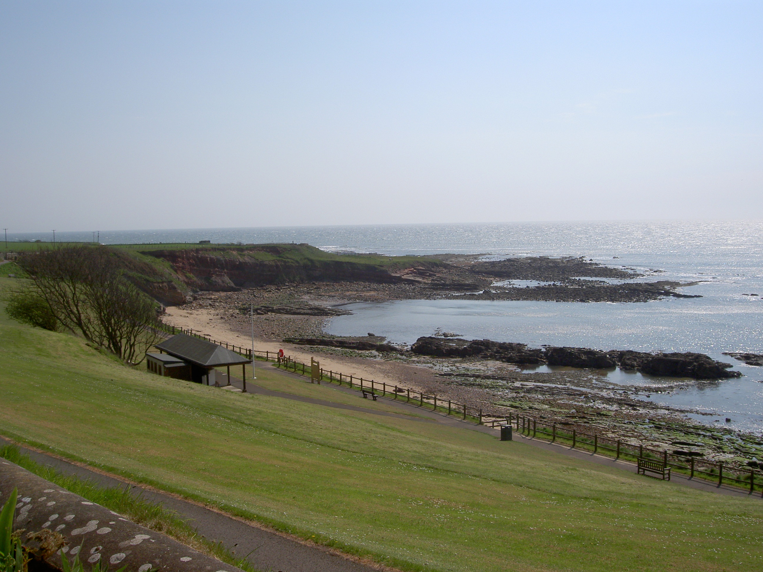
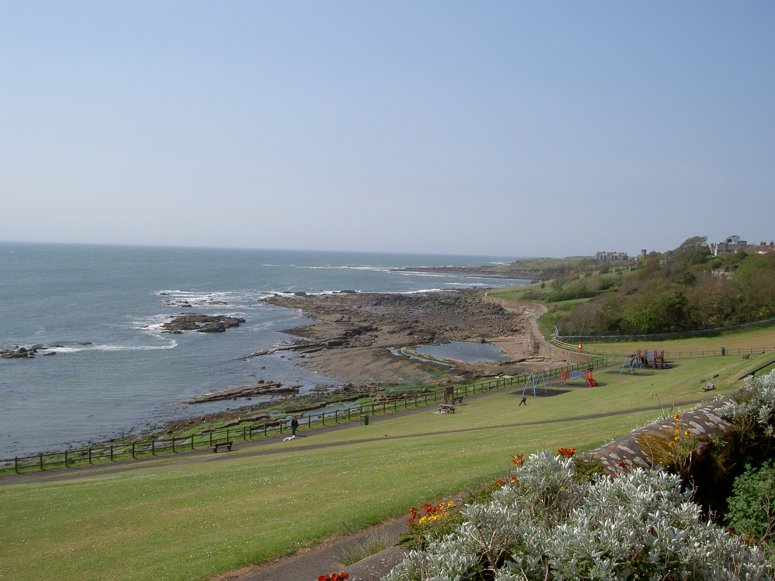
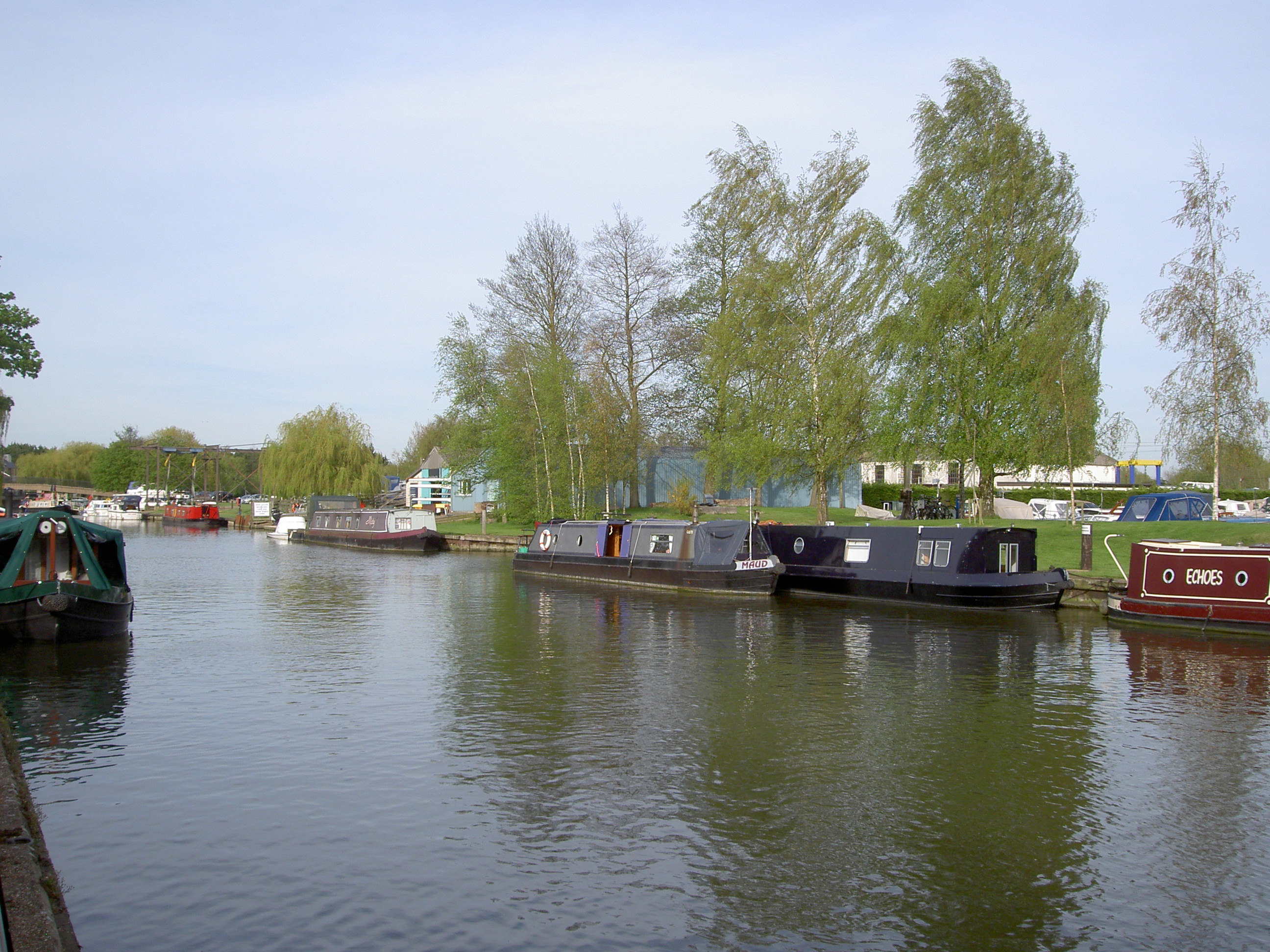
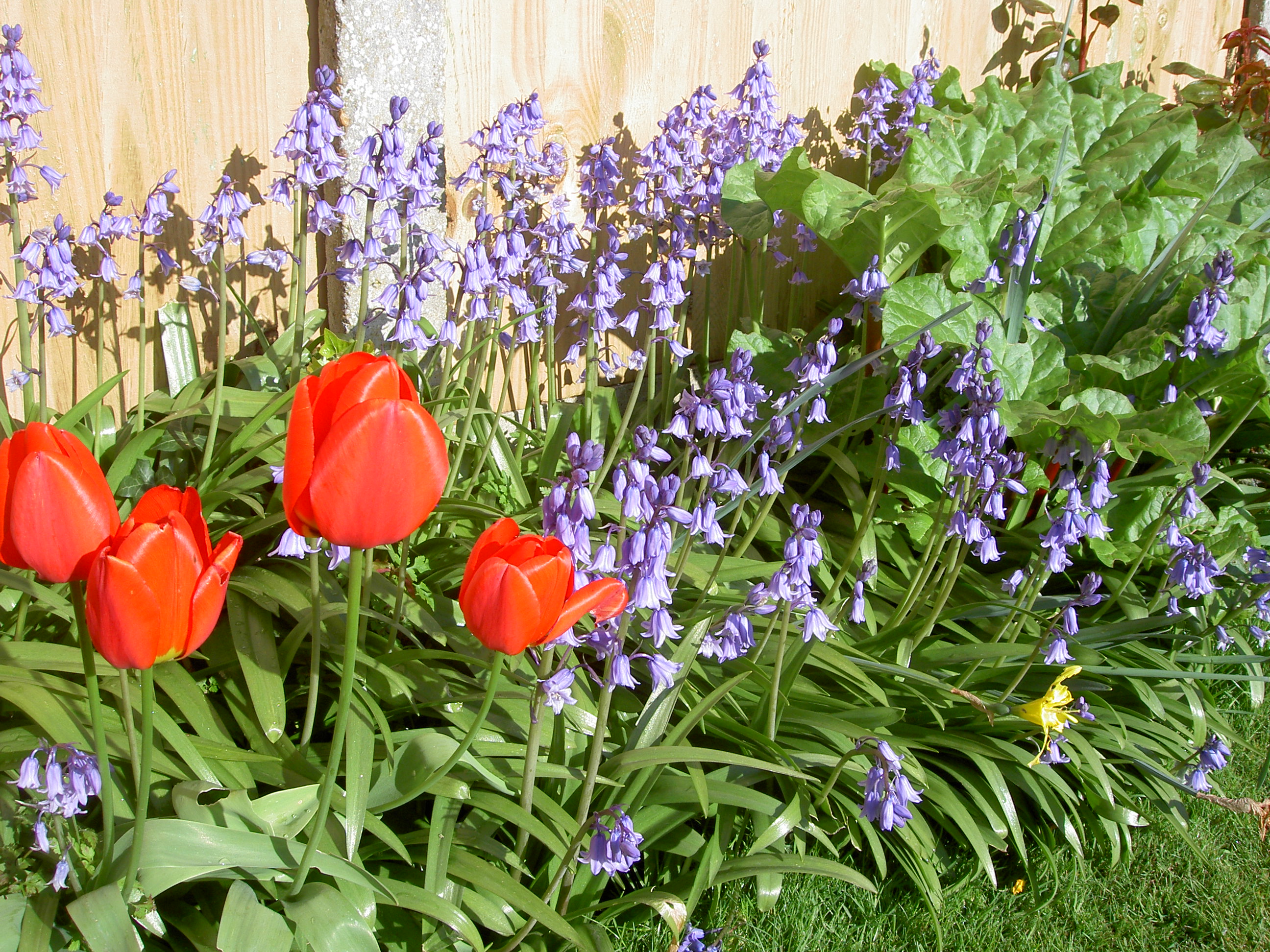
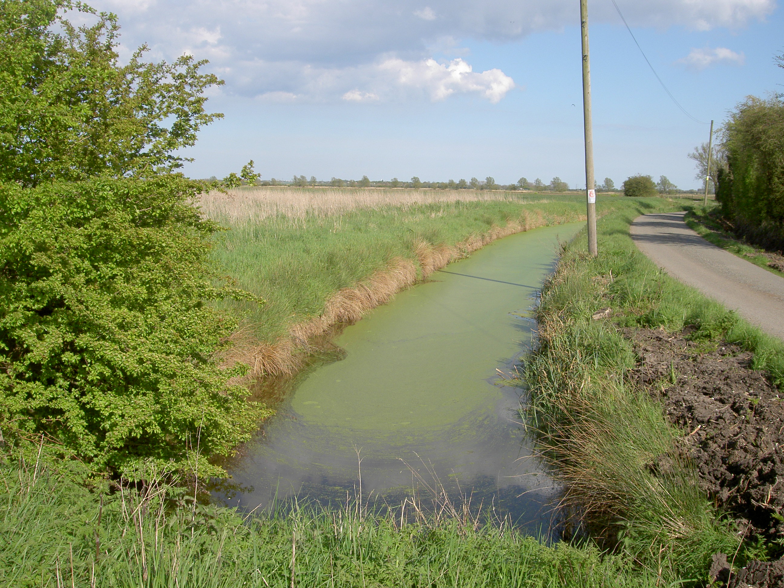
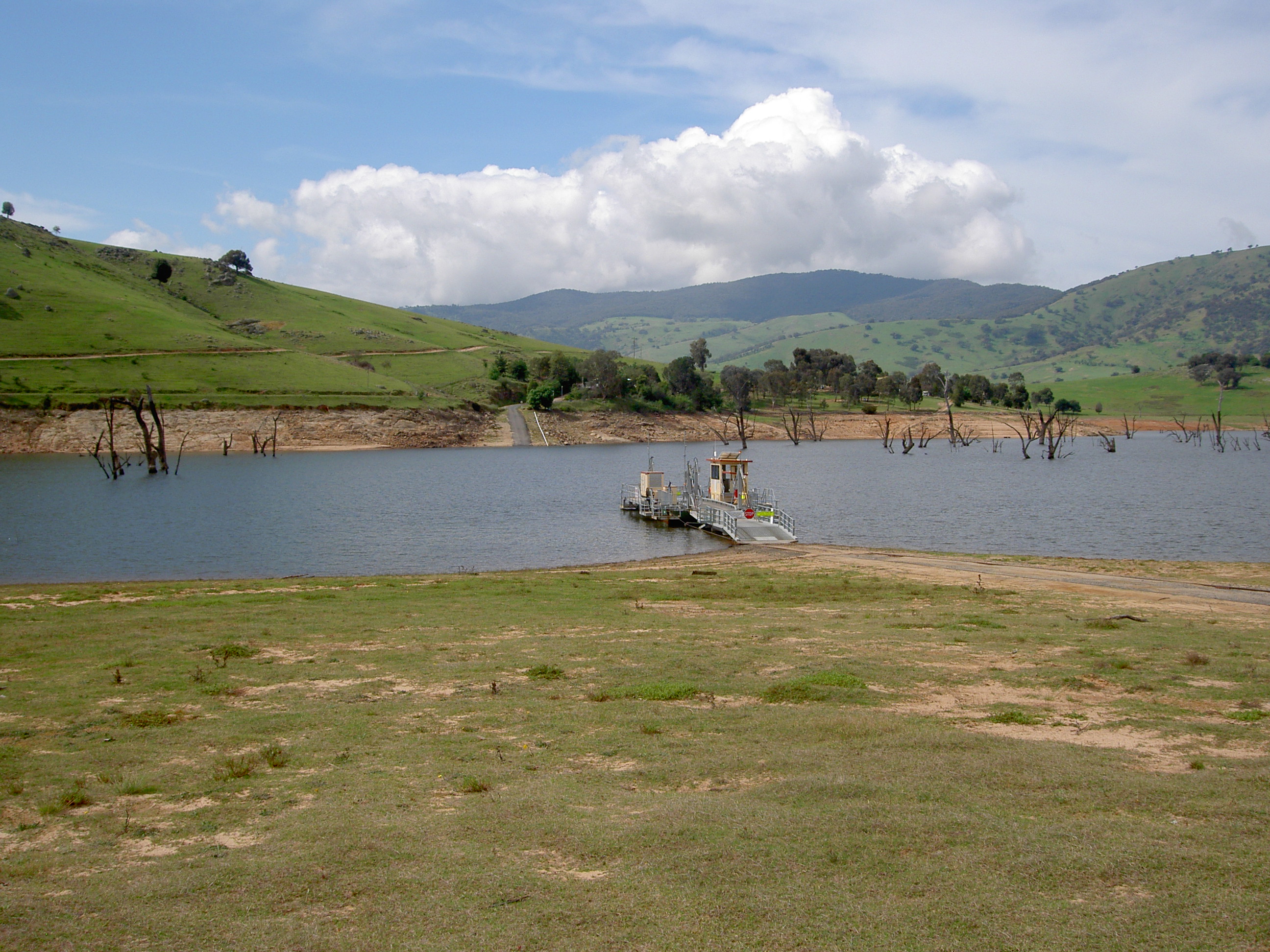
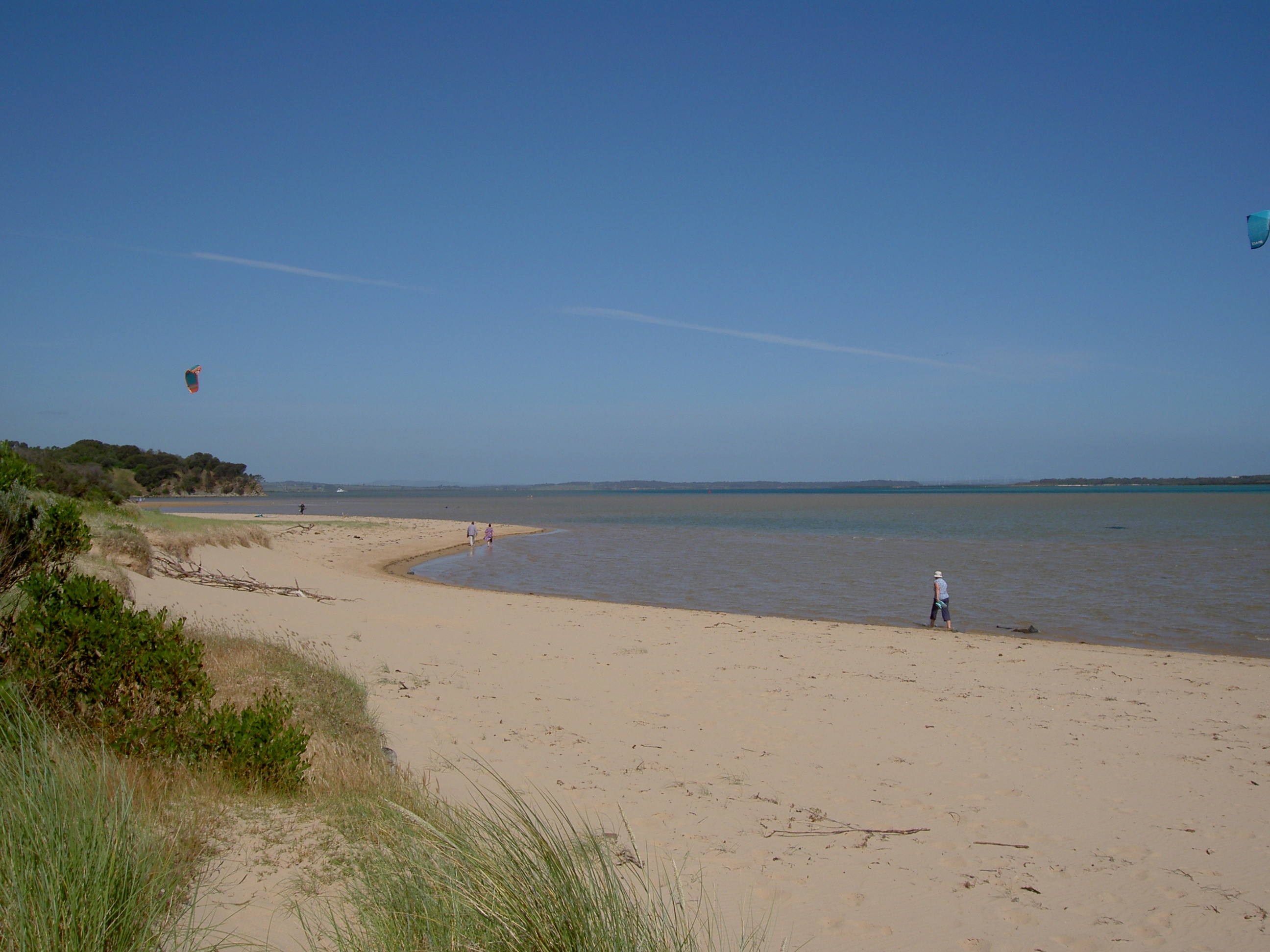
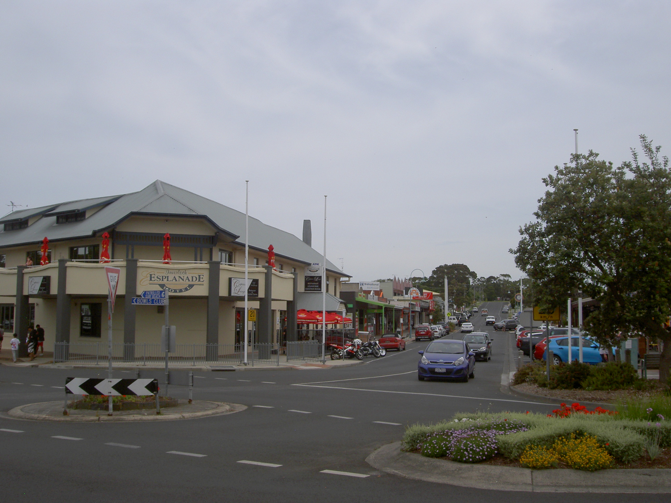
Inverloch, on the south-east coast of Victoria, just to the east of Port Phillip and Westernport bays and about 140K from Melbourne, is a delightfully small coastal holiday resort, with a resident population of about 5,000.This doubles during the summer holiday season and on ‘long weekends’. Over the March Labour Day weekend, there is a very successful and enjoyable Jazz Festival, at which the bands play mostly traditional jazz. There is very little industry in the area, other than those that service the tourist trade; and agricultural activities, including cattle and wineries. There are, of course, many rental holiday apartments, cafes, touristy shops, a couple of pubs, and caravan parks. We stayed for a few days at the Inverloch Foreshore Camping Ground, which is owned by the local council, but managed by the managers of the adjacent Big 4 Caravan Park. One of the main features of the Foreshore Camping Ground is that is caters exclusively for travelling caravans and campers—-there are no permanent on-site vans or cabins—-which gives it a much more open and relaxed feel. At the moment, it is less than 10% full, this being just before the main holiday season. There were a few groups of caravans and tents, perhaps being family groups, or perhaps some clubs. But there was plenty of space and it was all very quiet. The toilet facilities were as clean as any we have experienced, and entry to them is controlled by a plastic wrist band with some embedded programmable electronic device, to prevent non-campers, and there were many of them on the beaches, using the facilities. As its name suggests, The Foreshore is right there—on the foreshore, with only a shrub-cladded sand dune between the park and the beaches of Anderson Inlet.

Through the sand dune toward Anderson Inlet


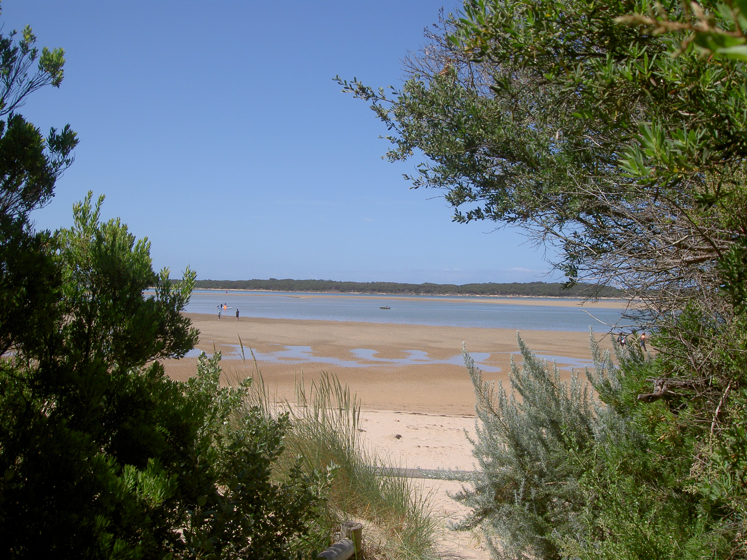
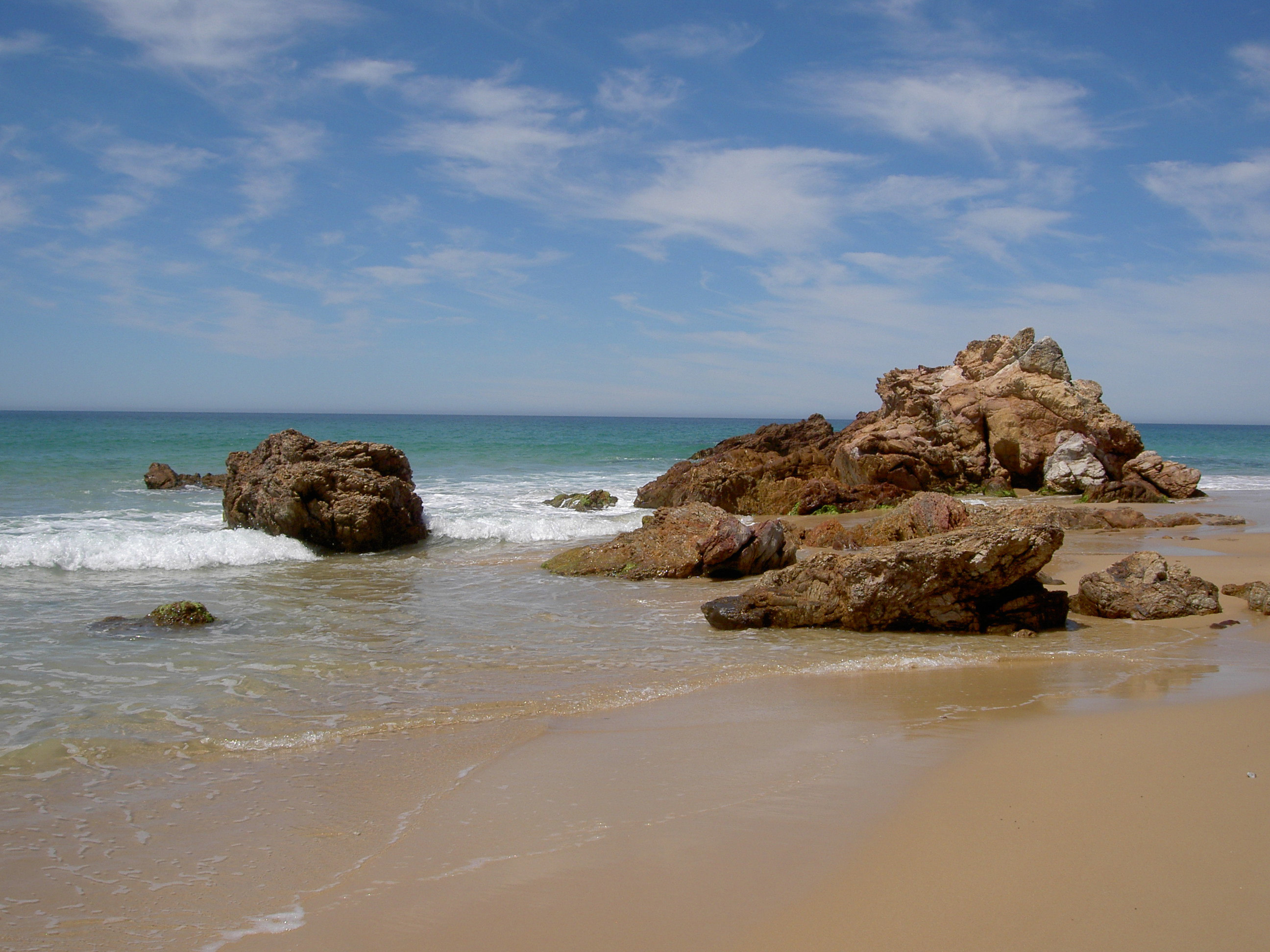
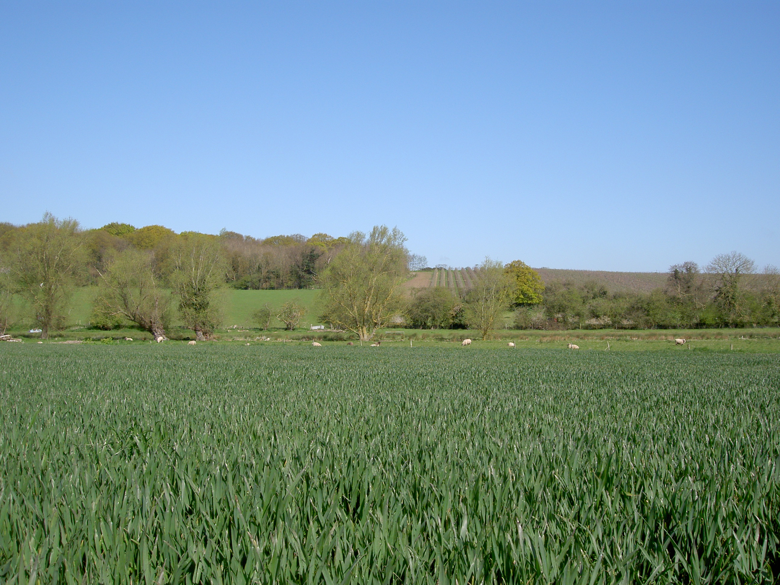
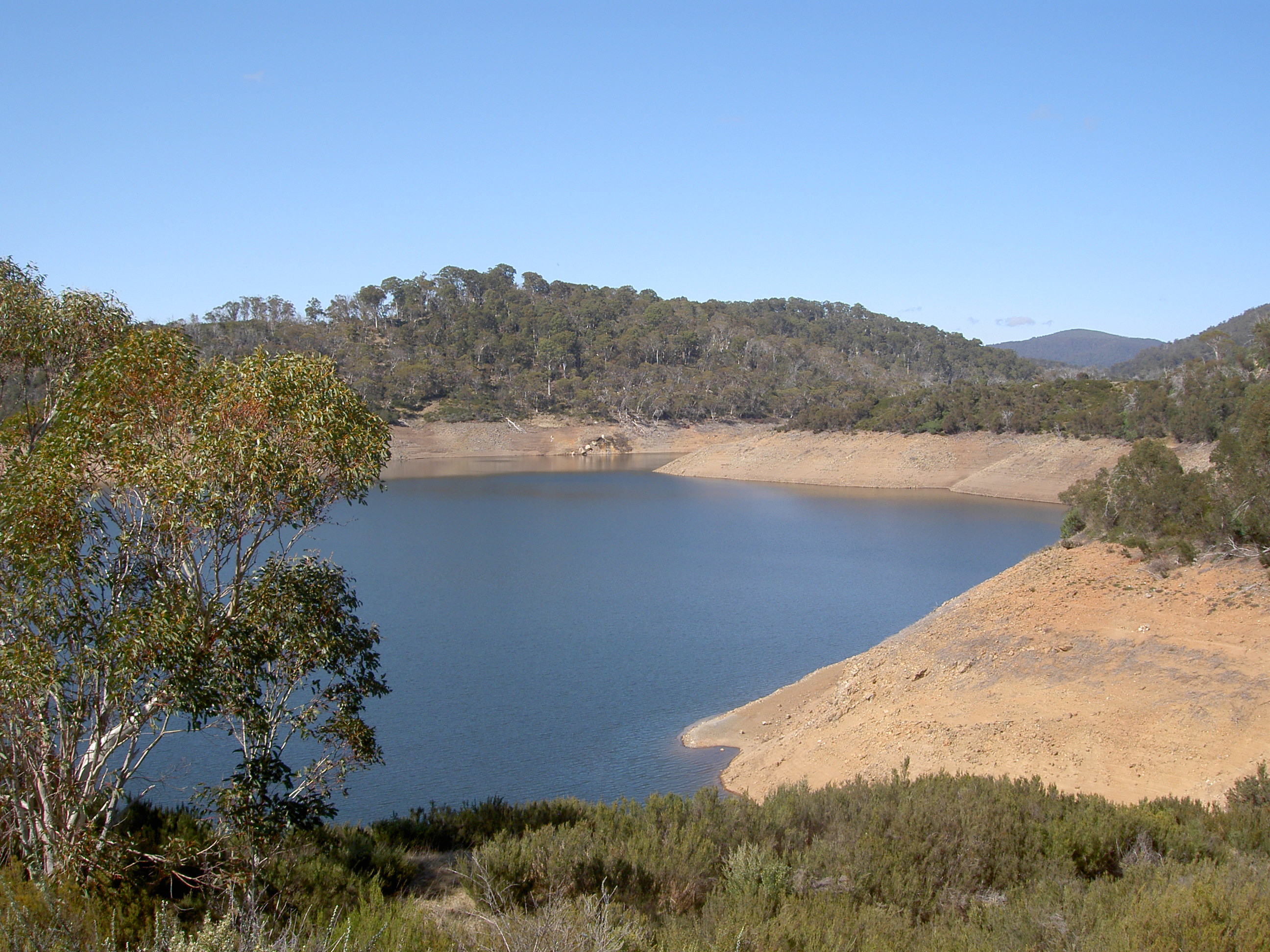
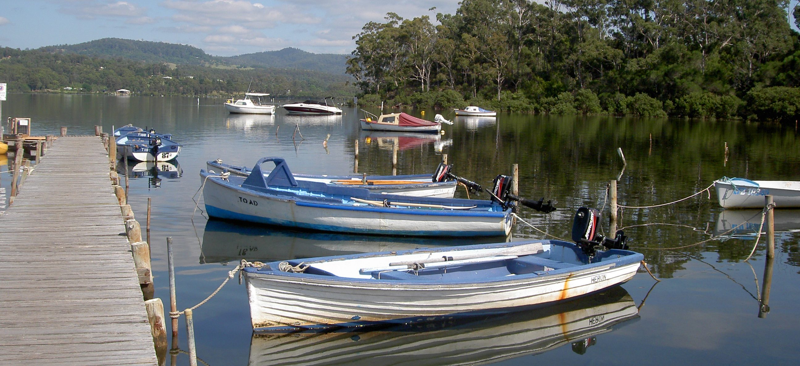
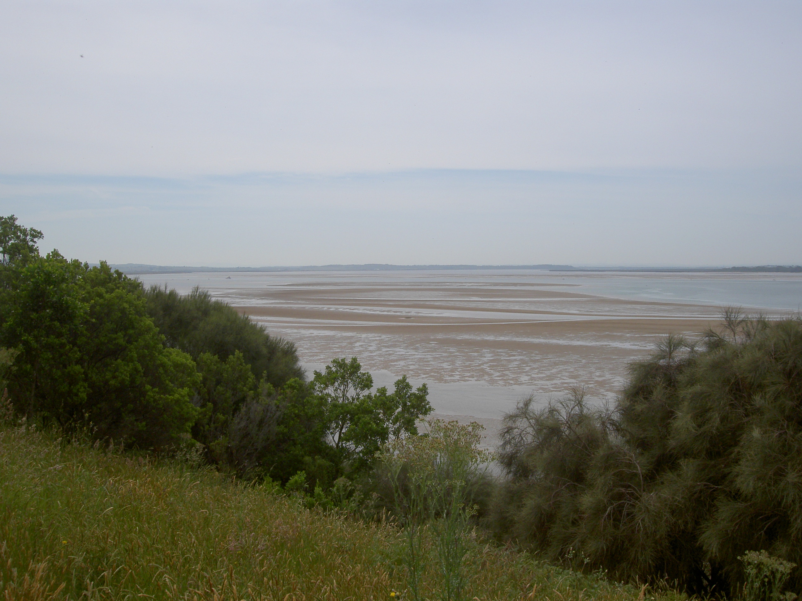
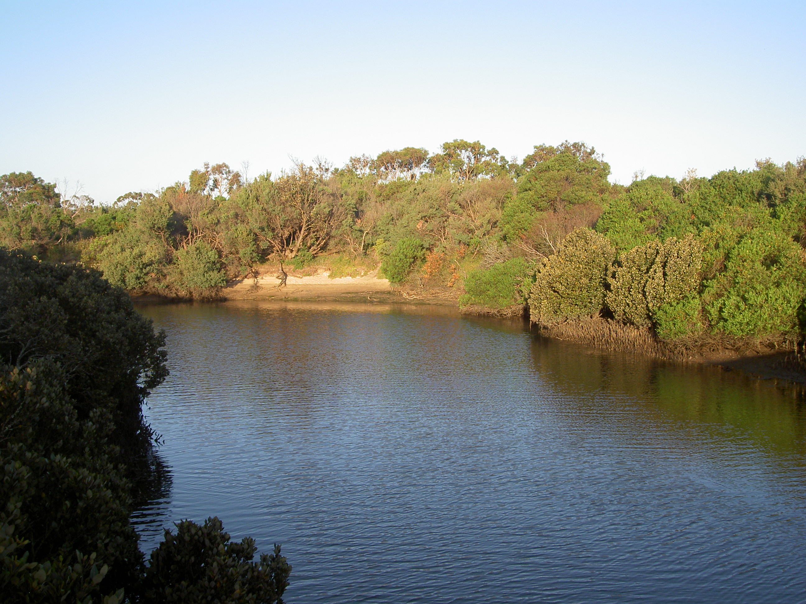
Anderson Inlet, named after the Anderson brothers who were the first Europeans to settle in this part of the world, is formed as the estuary of the Tarwin River. For the most part, it is a very shallow inlet—one can paddle out for about 200m, and not get your shorts wet—-but it does have the main channel of the Tarwin running through it, and the position of the channel is constantly changing, sometimes near the Inverloch side, and at other times, way across toward the Venus Bay side. At the moment, it starts the other side, take a broad sweep across toward Inverloch, and then sweeps further off and out into the sea. We have been visiting here for over 40 years, and we have never seen so much sand exposed on this side for many years, but no doubt in a few years it will be different again. The inlet is very popular with fishing enthusiasts, both boaties and beach fishers. It is also popular with the kite-surfers, kayakers, and small dingy sailors, and there have been a few of those dreadful jet-ski boats out as well. But all in all, it is a very quiet and pleasant place to be.

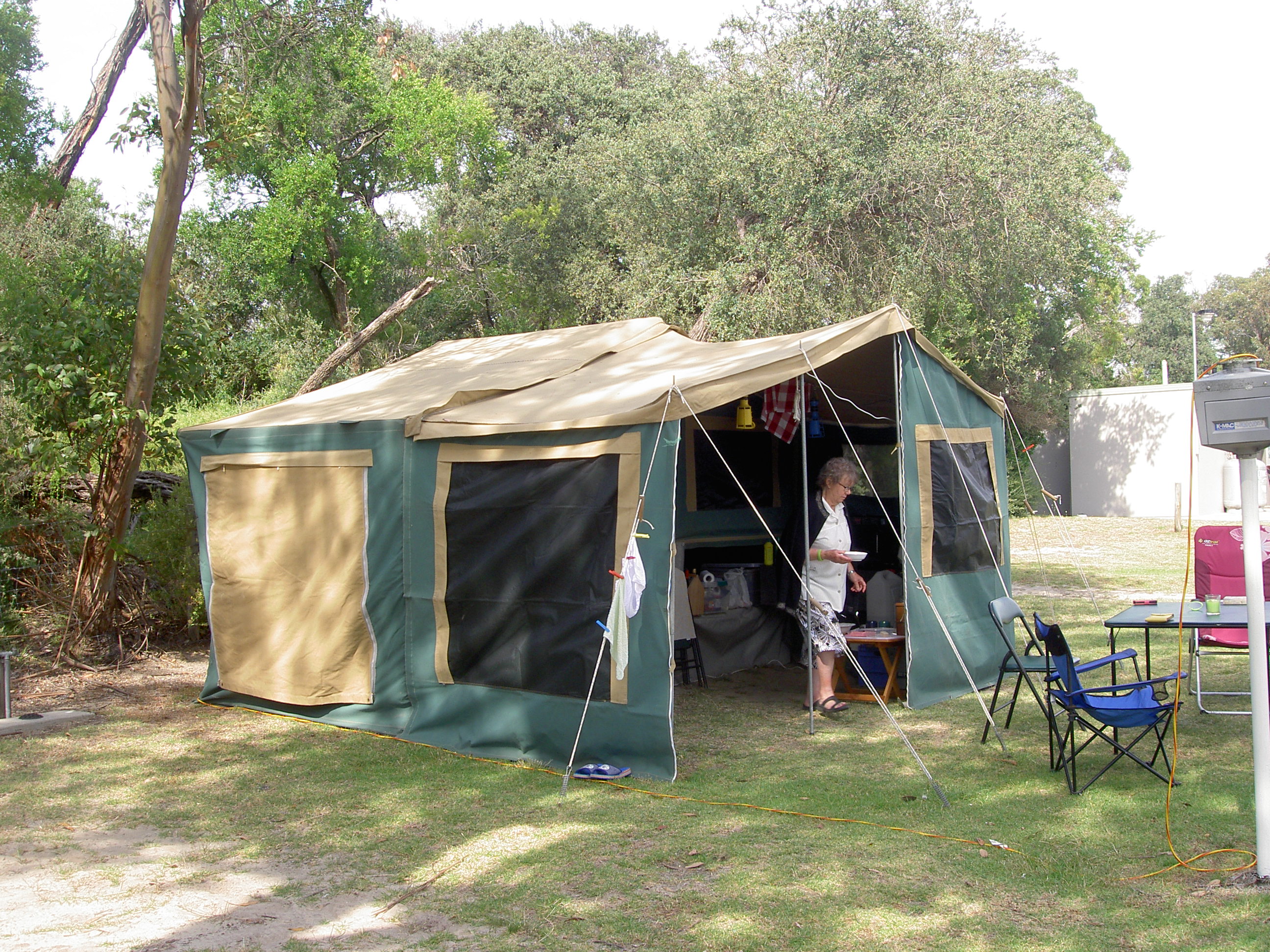
We were camping for the first time since Ann had her new knees a couple of years ago. Having recently been to Mallacoota with our camping friends (but not camping there—we rented a house), we thought we would have another go at camping just to see how we went, and not wishing to drive too far, decided on Inverloch as it is only a couple of hours from home. We arrived about mid-afternoon on Friday, and soon had the tent up. It takes only a few minutes to erect the basic tent, then a little longer to erect the annexe, and then ages to get all the small bits and pieces installed. Not the least of these is the electric cabling—so necessary for Ann’s piece of medical equipment, but also for all those other necessities of camping, the laptop computers, recharging the I-pad, two mobile phones and the dongle for Wi-Fi and internet access. Can’t possibly go away without them! Then there is the fridge, the kettle and the toaster. No slumming it for us. Our camper has a very well appointed kitchen, including a kitchen sink and gas stove, and that most essential item, a balloon whisk!

Our Camper
Our Camper

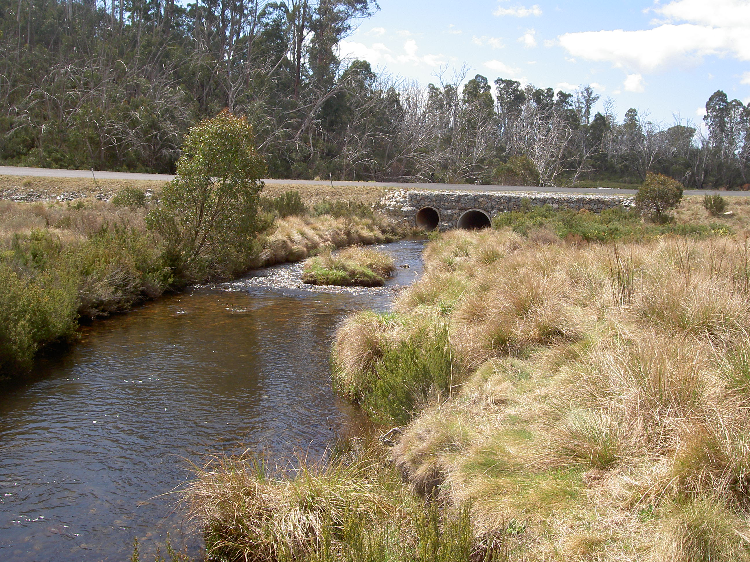
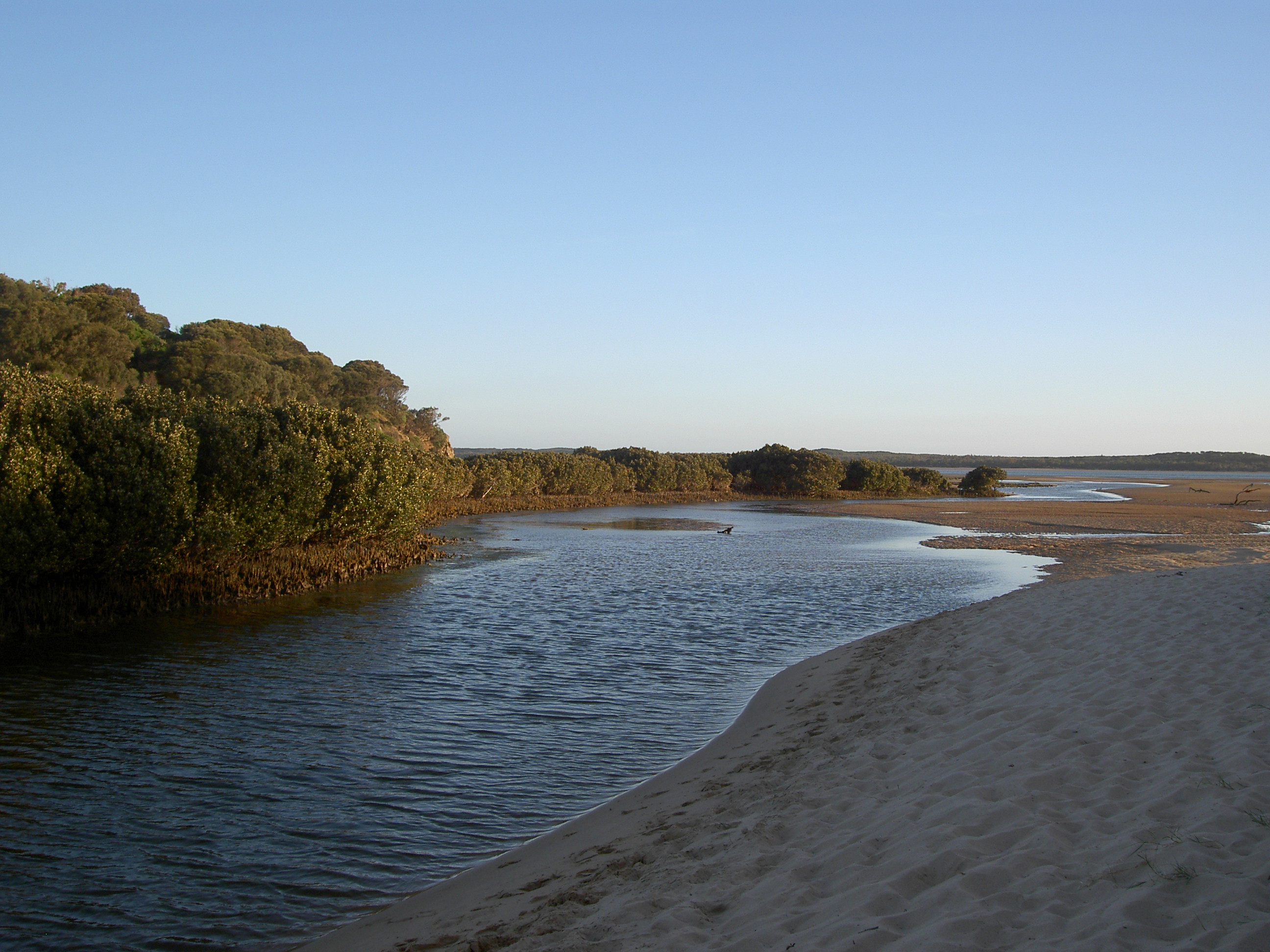
We had a good walk along the sand toward Screw Creek. When we first arrived in Australia in 1971, I fished in Screw Creek alongside my

Anderson Inlet, low tide, looking up-stream

father, and we always caught a few bay trout and silver trevally. One time, further upstream in the creek, we caught the biggest black bream I have ever seen. I think it was one of the children, then aged three and six, who cast in, only a few centimetres into the water. The bream took off across the creek, and it took more than 10 minutes to reel it in. I doubt there has been a larger fish caught since, even though the creek is one part of the inlet that appears not to have changed a bit! We decided not to walk further on this first evening, and returned to the tent for a chargrilled steak for dinner. We were surprised how cold it got on that first evening, and not having used the tent for a while, nor properly airing it before we went to bed, we froze. But getting up at 3.00am for a necessary toilet trip, we were rewarded for the cold night by the most glorious show of the Milky Way imaginable. Not a cloud in the sky, crystal-clear air, and starlight you could almost read by. Brilliant! And very much worth enduring the cold trip to the loo!

Anderson Inlet, High Tide


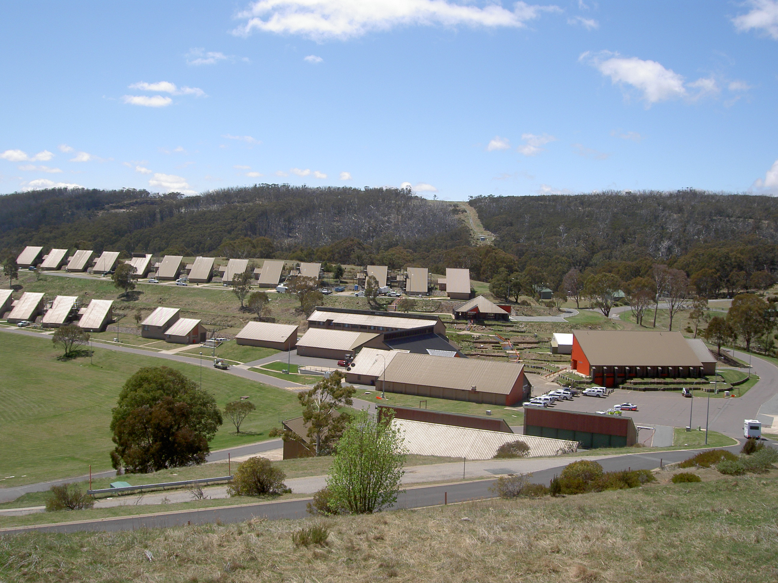
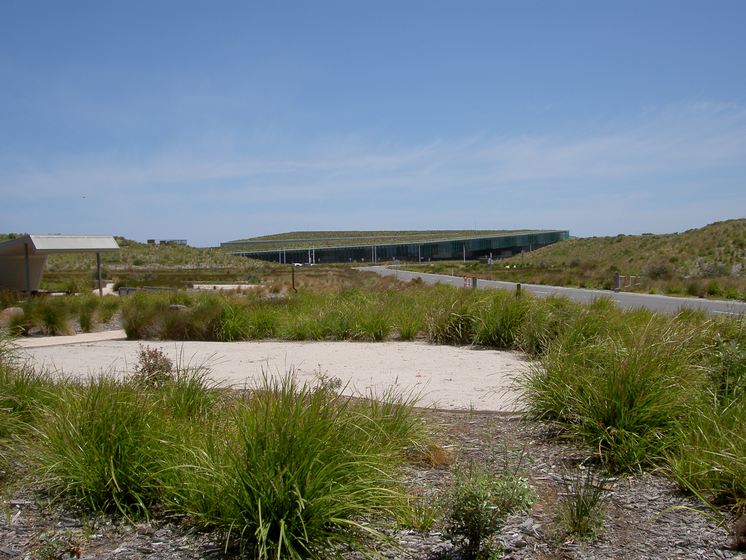
On Saturday, daughter Helen and her partner Dragan came from Melbourne to spend the day with us; and my sister Wendy and her husband and younger son also paid us a short visit. We had a lovely day. Whilst some sat around talking, Dragan and I drove around the area looking for somewhere nice to fish. On the way, we called into the Desalination Plant near Wonthaggi. Controversially built at great expense, Victorians are paying about a million dollars a day for it, and so far, two years after its completion, not a drop of water has entered the system! But I have to admit it is a magnificent building from an architectural point of view. Far from being a blot on the coastal landscape, as many feared it would be, it is almost invisible, blending very well into the sand dunes, and with its roof a living plantation of local vegetation.

Desalination Plant
Desalination Plant

The fishing proved to be mixed. I caught the most fish, six, to Dragan’s one. But mine were all small toadfish, whilst Dragan’s was a very nice silver trevally. (but still not quite big enough to eat!). So failing to catch suitable fish for dinner, we had to make do with the prawns I had brought frozen from home, cooked to perfection in a mild chilli sauce, served with rice and caramelised bok choi. After dinner, our guests departed and we took another stroll along the beach before turning in for a very good night’s sleep.

Sunday morning began warm, and the temperature rose as quickly as the sun did, reaching the low 30s by mid-day. It was also very humid, and not really very pleasant at all.

Screw Creek,
Screw Creek,

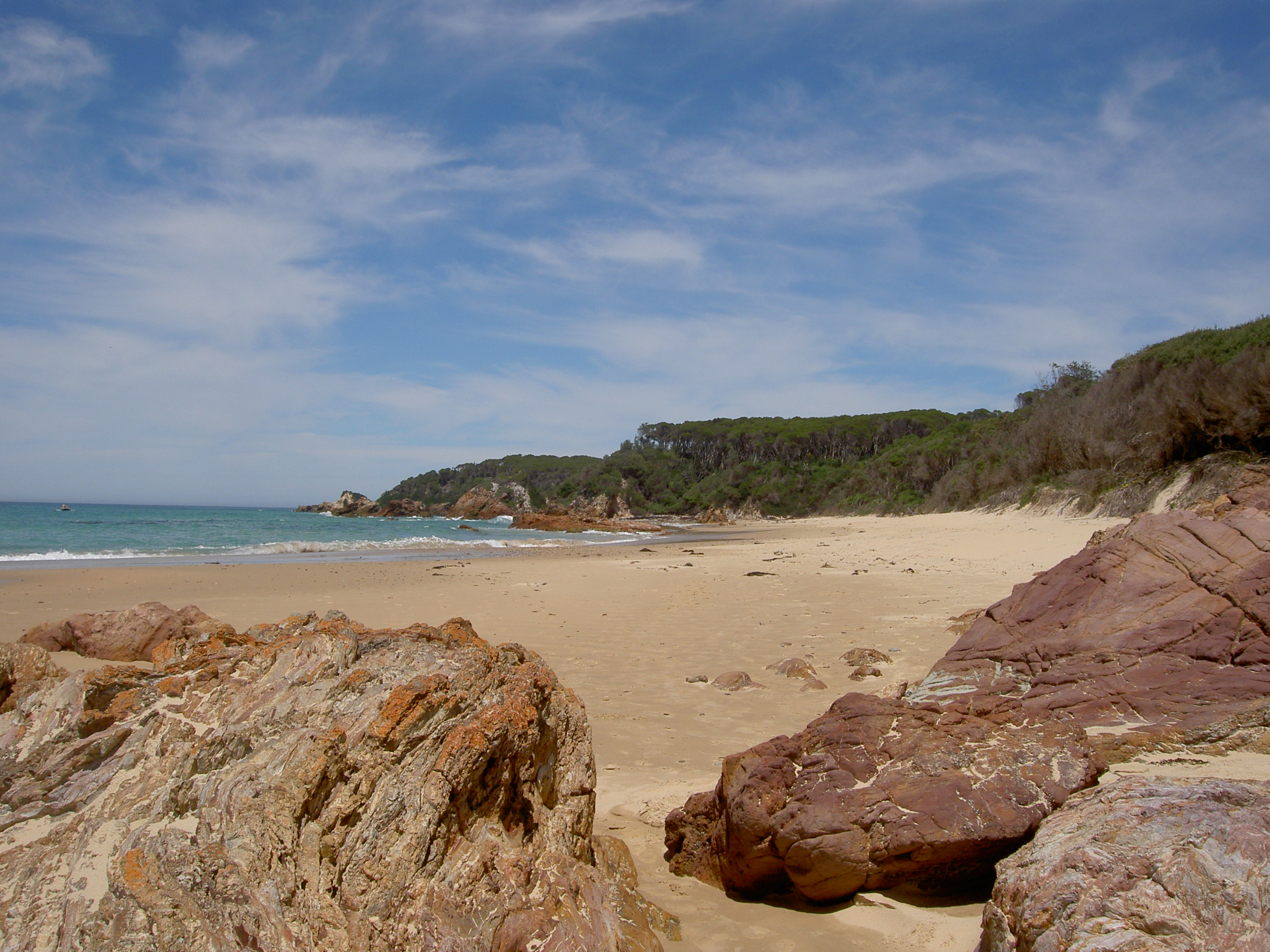
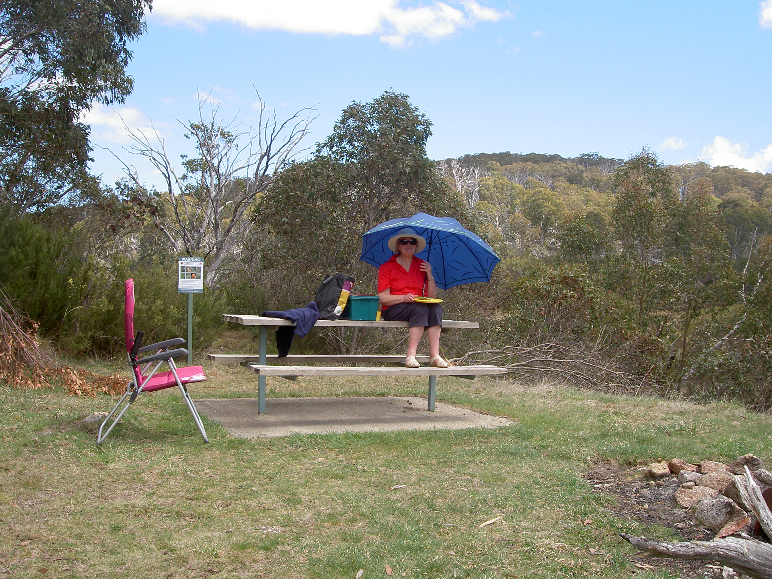
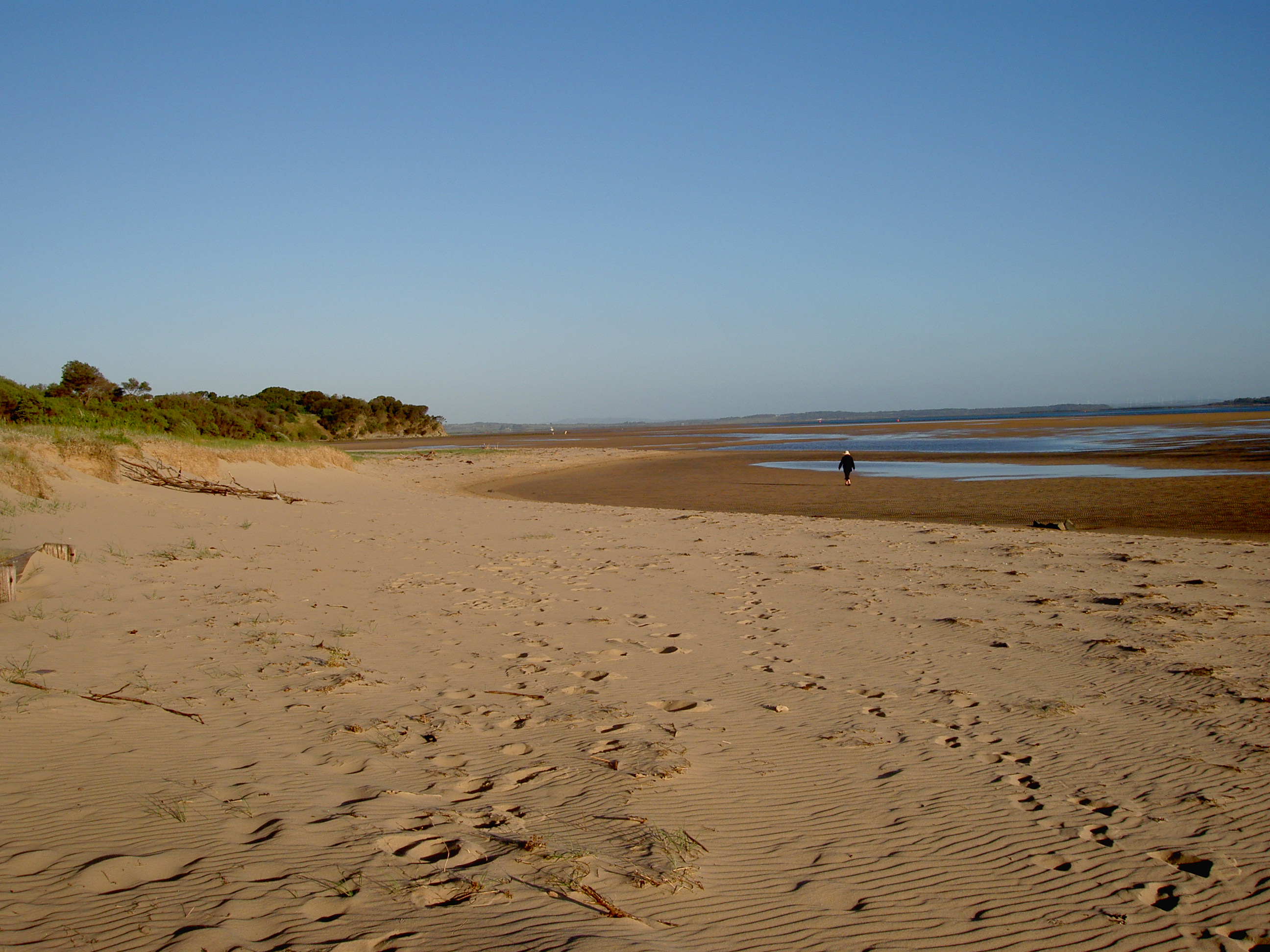
It was necessary to find a shady spot which also had a bit of breeze, which we did, and where I started this blog. But before it got too hot, we did walk through the bush to Screw Creek, over the bridge, and past the bench erected in memory of my sister’s late father-in-law. The bench was originally located near the beach on the western side of the township, but was relocated to its present position when erosion of the beach threatened to wash the bench into the sea. Our walk then took us to the top of Townsend Bluff, which commands great views of the inlet, both inland and toward the ocean.

View from Townsend Bluff

One interesting legend of the area involves Screw Creek. Legend has it that many years ago, (probably as long ago as defined by the Once upon a time start of fairy stories!) a bloodthirsty pirate secretly dropped anchor in the then much deeper Anderson Inlet, and took chests of his plunder, comprising gold and diamonds, up Screw Creek and buried all his treasure somewhere in the bush along the banks. Many people have tried digging for it, but thus far, nothing has been found. Well, that is the story as told to me by my late father. However, a quick internet search revealed several other versions, one of which appears to hold some truth, as there was a well-documented theft in which gold coins did go missing; some were found, and a man went to prison for it! If you are interested, click on this link   http://www.oddhistory.com.au/gippsland/buried-treasures/  and it will take you to an interesting site, which details three stories. Interestingly, one of the stories includes a reference to the house at Tarwin Lower from which the ‘Lady of the Swamp’ went missing, presumed murdered!


Screw Creek, upstream from foot bridge

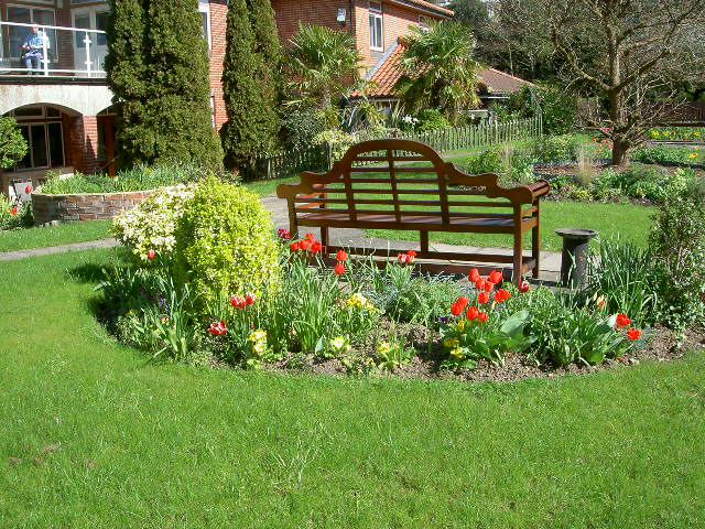
We did walk up into town, just for a cold beer, and for the exercise. There is not a lot to the main town, just a couple of pubs, a couple of bakeries, a few cafés, a chemists, a few clothes shops and gift shops, a sports/fishing tackle shop, a couple of ‘op-shops’ and a supermarket—-which is really all a small sea-side town needs. But it is very relaxed and a pleasure to walk around—-when it is not to hot and sticky!

Inverloch main street

As the Sunday afternoon weather became hotter and stickier, with a sky that looked a bit stormy, I checked the BOM site on the computer. Lo and behold, there was an urgent ‘severe weather warning’ for the whole of Gippsland. Damaging winds, torrential rain and flood warnings. That was all we needed. So many times have we left campsites in the rain, and had to put the tent up to dry off when we got home, that we decided on the spot to decamp and head home. So, at about 5.00pm, we started the packing up. It was hot and sticky, and the sky looked very threatening, so we worked very fast. So fast in fact that I had packed everything into the car, including the fridge and other large stuff into the  back, before I realised that I had forgotten to retrieve the tow-ball from the spare wheel well in the boot! Bugger! I removed some of the stuff, thinking that perhaps I could lift the cover just enough to get my hand in and retrieve the tow ball, leaving the fridge in situ. I got my right hand in OK, but trying to hold up the fridge and other stuff with the left hand proved to be a kilogram or so too much, and having got the ball into my hand, I was rather like the monkey trying to get the reward out of the coconut shell, and couldn’t retrieve my hand with, or without, the ball! After much swearing, I did get both hand and ball out, and eventually got the ball onto the tow-bar. We left the trailer in the park and went to the pub for some dinner before leaving Inverloch. But there was nothing on the menu that either of us fancied, so we went to the nearby pizza place, and both of us enjoyed really excellent pizzas. Then it was back to the camping ground, hook up the trailer, and away to Melbourne. During the packing up, both Ann and I were savagely attacked by mozzies and sand flies, and on the way home, my right wrist throbbed from the exertions of trying to retrieve the tow-ball without removing the fridge first, and my ankles itched worse than I have ever known, despite plastering them with anti-itch lotions and potions. Ann fared even worse, with her bites developing into blisters as big as half-walnut shells, necessitating a trip to the doctor the following day. To add insult to the injuries, when I got up on Monday morning and checked the BOM site, I discovered that they had actually cancelled the severe weather warning later on Sunday night, and we could have stayed another day and still got home with a dry tent. Such are the joys of camping!

Will we go camping again? Probably, but I’m not sure when or where that might be!

Sketches of Mallacoota

November 3 2016

November is traditionally the time when our group of friends that we refer to as The Campers take themselves away for a few days. In years gone by we all took tents or caravans, but as the ravages of time took their toll, not only has the group diminished in numbers, so the tents and caravans have given way to more solid accommodation. We now rent houses that can accommodate the 8 of us in comparative comfort. This year, our short break was supposed to start on Thursday November 3, but actually started a couple of days earlier, on Cup Day. Not that we are into horse racing, but an opportunity to share a BBQ and to watch the race that purportedly stops the nation in the company of Fellow Dickensians, was too good to pass up. And an invitation to attend an all-Beethoven piano recital at a house concert in Drouin (which is on the way to our final destination of Mallacoota,) on Wednesday morning gave an additional reason to start proceedings earlier.

The recital started with Sonata No. 13 in Eb major, and was followed by Sonata No. 14 in C# minor, commonly referred to as The Moonlight Sonata. The first movement of this very well-known sonata is usually played at a very slow tempo, but our pianist, Brian Chapman, believes it should be played somewhat faster. Beethoven’s original manuscript gave the tempo mark for the first movement as which is the allabreve sign, reducing the number of beats in the bar from four to two, whilst still maintaining the original pulse. The result is effectively a doubling of the tempo. You can find a more detailed (and accurate!) explanation at Brian’s website which is http://www.qedinteractive.com.au/LVB27-2.htm

Following the interval, Brian played Beethoven’s Sonata No 20 in G major, his so called Easy Sonata, then Sonata No 27 in E minor, and finally Sonata 23 in F minor, the Appassionata. Whilst the whole recital was wonderful, Brian’s playing of this monumental piece was outstanding, and left the audience absolutely spell-bound. I can honestly say I have never heard the Appassionata played better than on this occasion, and I doubt that I ever will!

After a very nice lunch, we bundled ourselves back into the car and headed for Lakes Entrance where we decided to break the journey to Mallacoota. Lakes Entrance has been the subject of a previous blog, so I shall say no more about it, but will go direct to Mallacoota.

We first visited this small coastal town, in the far eastern corner of Victoria some 40-odd years ago, and I don’t think we ever went back! It’s not that we didn’t like the place; rather it is because it is on a road to nowhere else. We have very often passed the end of the road to Mallacoota where it joins the Princes Highway at Genoa, on our way to and from Merimbula, but as it is some 40 km from there to Mallacoota, we have always said that ‘one day we shall take that road and visit the place again’—and that is what this trip was all about. Our accommodation had been booked well in advance, and we could not have chosen a better place. Located halfway up a gentle hill, it commanded stunning views of the extensive lake system formed from the Wallagaraugh River, as it meets the sea.

View from the deck
View from the deck

The house was beautifully furnished, had plenty of room for all of us, and had a very well-appointed open-plan kitchen. There were even two balloon whisks! There were koalas in the trees across the road, and an amazing number of birds in the native trees and bushes in the garden. We even saw scarlet honeyeaters, which none of us had seen before. In fact, one of these brilliantly coloured minute birds knocked himself out trying to fly through the double-glazed window, but we nursed him back to health, and he was soon restored sufficiently to fly away—and he continued to reappear in the callistemon tree at the end of our deck.

Scarlet Honeyeater
Scarlet Honeyeater

And despite being in such a lovely bushy setting, it was only an easy five minute stroll to the shops and cafés. In fact, it could not have been better. We spent a little time exploring the town, and the nearby beaches (which really are magnificent) and lakes, did a little fishing, quite a lot of walking, and a great deal of sitting around doing very little other than watching the birds, talking, reading, eating and drinking.

Beach at mouth of  Betka River
Beach at mouth of Betka River
Beach near Betka River


The town centre, comprising one road 200m or so long with shops on both sides and car parking in the middle, and the pub, was quite quiet, this still being outside the peak time of the summer holidays. When the main holiday period starts at the Christmas/New Year time, the population swells from the resident population of about 1000, to over 9,000, with most of the increase being campers and caravaners. In addition to the spectacular coastline with its Wilderness Coast walking track some 100 km long, and the extensive lake system, the town is pretty much surrounded by the 87,500 hectare Croajingolong National Park, which has been classified by UNESCO as a World Biosphere Reserve. It really is quite unspoiled, and certainly worth a visit.

Since time immemorial, the area had been inhabited by the Bidawal People, a tribe of East Gippsland, (who spoke a dialect of the language which was spoken by the Kurnai tribes to the west) with European settlers arriving in about 1830. Henry Lawson visited Mallacoota in 1910, and the first four stanzas of a poem (Mallacoota Bar, one of two he wrote about the area), give a good impression of what it was like at the turn of the century:-.

Curve of beaches like a horse-shoe, with a glimpse of grazing stock,
To the left the Gabo Lighthouse, to the right the Bastion Rock;
Upper Lake where no one dwelleth — scenery like Italy,
Lower Lake of seven islets and six houses near the sea;
‘Twixt the lake and sea a sandbank, where the shifting channels are,
And a break where white-capped rollers bow to Mallacoota Bar.

Gabo, of the reddist granite, cut off from the mainland now —
“Gabo”, nearest that the black tongue ever could get round “Cape Howe”;
Gabo Island, name suggestive of a wild cape far away,
And a morning gale by sunlight, or a sea and sky of grey;
Gabo, where cold chiselled letters on the obelisk record
How the Monumental City sank with forty souls on board.

To the west the lonely forests, on the levels dense and dark
Native apple tree and bloodwood, wattle, box, and stringybark;
Land of tree-marked tracks and hunters — to their glory or their shame —
For a law makes Mallacoota sanctuary for native game;
To the east the rugged Howe Range, running down without a scar
To the mighty moving sandhills — close to Mallacoota Bar.

And the folk are like their fathers — bushmen-sailors, fishermen —
And they live on fish and tan-bark, with a tourist now and then;
And of hunting? Well, I know not. And what matter if we know
That they did a bit o’ smugglin’ or o’ wreckin’ years ago?
For I love these kindly people, and ’twill give my heart a jar
When I see the figures fading on the sandbank by the bar.

It is interesting to note the reference to “six houses by the sea” and “a tourist now and then”, given the number of tourists that now flock to the area!

Showing Mallacoota Bar

A small timber lighthouse was installed on the nearby Gabo Island in 1854, (following the wrecking of the SS Monumental City) and a permanent stone lighthouse erected in 1862. By the 1880s, fishing was well established. Coastal shipping was an important means of transport for the entire coast, but it was not without its dangers, as the Mallacoota Bar has always been a treacherous stretch of water, and many small coastal vessels came to grief trying to cross it to enter the lake system. But the loss of the Monumental City in 1853 was due to human error, and she was not actually attempting to cross the Bar.

The Monumental City was an American-built wooden hulled steamer, and was the first steam ship to cross the Pacific. She was brought to Australia as a coastal trader and passenger ship, and had made one trip from Sidney to Melbourne. On her return trip, she came too close to the coast, and foundered on the small uninhabited and uncharted Tallaberga Island just off the coast between Gabo Island and the Mallacoota Bar. For reasons unknown, the captain did not order the life boats to be deployed, rather he ordered one boat to carry a rope to the mainland, and after a few unsuccessful attempts, the rope was in place. However, many drowned trying to haul themselves along the rope, and many more were simply washed off the ship and drowned. In total, 33 (some documents say 37) of the 45 crew and 28 passengers died, the majority being passengers. There is now a monument to those who died located on the cliff at the ocean end of the camping and caravan park overlooking the bar.

Monument to SS Monumental City


On the inland side of that same monument is a plaque commemorating the establishment in 1909, of a writers group, founded by Australian writer E J Brady, who was a friend of Henry Lawson. By 1910, after spending time in goal for non-payment of the maintenance money to his wife Bertha, and several stints in rehabilitation trying to dry himself out, Lawson’s creativity was deserting him, and several of his friends in Sydney, including Tom Mutch, the NSW Minister for Education (who had set up a committee to help Lawson), sent him on the trip to visit Brady at Mallacoota. The visit did Lawson a lot of good, and revitalised the man and his writing. Returning to Sydney, he continued with some good writing, and the start of the Great War restored his youthful zeal for a cause. It has been said that the visit to Brady probably saved Lawson’s life, actual and literary, getting him back on an even keel for a while. Brady continued to live in Mallacoota until his death (at Pambula) in 1952, aged 83.

Monument to E J Brady

Apart from the obvious tourist activities being a major employer in the area, the next most significant employer in Mallacoota is the abalone industry.  Wild abalone are harvested by about 26 licensed divers and processed in the local factory, with most of the product being exported. Personally I have never tried abalone, but everything I hear about it as a ‘delicacy’ rather puts me off it!

There is also a fledgling abalone pearl industry, but unfortunately, Gerry Menke and his wife, who started the venture some six years ago, were among the victims of the Malaysia Airlines Flight MH17, brought down by a missile over Ukraine in July 2014. The ‘Blue Pearl’ abalone industry in Akaroa, New Zealand, is world famous, and one hopes that this component of the abalone industry of Mallacoota can recover from its terrible loss.

For golfers, there is a very nice Golf and Country Club at Mallacoota, with generously wide fairways, and perhaps more kangaroos than are really necessary. Unfortunately the only day we had available to play, the course was closed for some major competition, so I can’t comment on the condition of the greens. But it all looked rather inviting.

Mallacoota is definitely a place to which we would return, but certainly not during the peak tourist season!

At the end of our all too brief stay at Mallacoota, we moved on to spend a few days at Merimbula. As that has been the subject of several previous blogs, all I will say about this trip is that once again Ann saw whales off Haycock Rock, and that once again I failed to catch any fish! But we did see a splendid goanna strolling across the road at Pambula Beach.

Goanna at Pambula River

Travelling South

At the end of our few days in Scotland, it was time to travel south back to Kent. So on the last day we booked a couple of bed and breakfast overnight stops on-line, making our choices based partly on price, and partly on the photographs shown on the websites. Both places we chose were excellent, but because our geography and knowledge of Scotland and northern England was a little less than ideal, one was basically only just on the outskirts of Edinburgh, and the other was only just over the border into England, which left a much greater distance for the final drive than we had anticipated. But we enjoyed both places, and would certainly recommend them to anyone travelling to that part of the UK.

The first was at Dalkeith, just a few kilometres south of Edinburgh. We had no difficulty finding it, having safely navigated our way through the incredible road works either side of the Firth of Forth, as part of the new bridge crossing. The B and B, known as Smeaton House, was originally a 15th century courtyard castle which had been largely destroyed by fire in the 17th century, and subsequently rebuilt as a very nice, turreted country residence. One of the original towers has been incorporated into the restored building, whilst another, still ruined, forms part of the courtyard wall.

Smeaton House
Smeaton House

There are traces of the old moat, and two of the vaulted cellars are now used, one as the dining room and another as a sitting room. All the common rooms have an open log fire, whilst the bedrooms are centrally heated by radiators. It is a very lived-in and cosy, relaxing guest house, and is on an estate owned by the Duke of Somewhere, who is, apparently, one of the largest land holders in Scotland. The grounds are delightful, with pheasant (definitely) and deer (reportedly) roaming freely. It is currently leased to our host John, who runs it almost singlehandedly as a B and B.

Smeaton House
Smeaton House


John is an interesting character. He bought a mobile fish and chip van when he left school, before he was old enough to drive, and engaged an aged pensioner to drive it for him. It was clearly a very lucrative business, and he subsequently bought a fish and chip shop, and now also owns several properties in Edinburgh which he rents out. He has only recently entered the B and B business, and all the indications are that he will make a success of that too. He appears to be doing all the work himself, although he did call on his mother in Edinburgh to prepare the plate of fresh fruit for our breakfast. The fruit platter was followed by a full Monty breakfast, prepared to perfection. When it was time to leave and to pay the bill, we discovered that John was only able to accept cash; the reason being, he explained, was that he wanted to see how the business went before committing himself to a four-year contract for eftpos facilities. This meant that we had to pop back to Dalkeith and find an ATM to get the necessary amount of cash. We had deliberately run down the cash in our purse, as in Scotland ATMs give you notes of Scottish currency, which are not very welcome in England. So having taken out just the minimum we needed to make up the £75 we thought we owed, we returned to the B and B, proffered the cash, to be told it was only £60. So we still had £15 of the unwelcome Scottish notes left!

Leaving Smeaton House, we travelled south on the A68 through the Boarder Country. This is a wild and beautiful area, which, over the centuries, has seen more than its fair share of battles and skirmishes between the Scots and the English The road skirts the ancient Abbey town of Jedburgh, and anyone visiting this area for the first time would be rewarded for spending a couple of days at least here. However, we did not have that time, so continued on our merry way south to Knitsley, in County Durham.

Knitsley is more of a rural area than a village, on the outskirts of Consett, of which we saw very little. But once, Consett was one of the most important steel towns in the UK. In the 1840s, Consett was a village with a population of 145, but with the vast local reserves of coal, iron ore and limestone, it had a rapid expansion as the industrial revolution kicked off, and by the 1960s, the steel works alone employed over 6000 workers. Many more were employed in mining, and the many service and peripheral industries around mining and steel manufacture. But it couldn’t last for ever, and it didn’t last for long. By the 1980s thousands of jobs were lost as the steel mills and coal mines were closed, and unemployment reached nearly 40%. Today, Consett is largely a dormitory town for people who work elsewhere, and the town still has one of the highest unemployment rates in the country.

But just outside Consett, in the Knitsley area, is the delightful Old Mill Restaurant and Bar, which also has bed and breakfast accommodation.

Old Mill Restaurant and Bar

It is only a couple of miles or so from Consett, but it could be a million miles away in another world. At a cross-road of tiny country lanes, and with the old mill stream running in front, it is an idyllic setting. We did have a little difficulty finding the place, as I turned off the ‘major’ country lane (which wasn’t very wide) into a very ‘minor’ country lane one intersection too soon. The lane we took was little more than a farm track, and fortunately we didn’t meet any on-coming vehicles. But we did meet a small flock, perhaps six or seven, of very small lambs! It was amazing how they were too frightened to run back past us, but as they took flight along the lane in front, they suddenly stopped for a moment or two to eat the lush green grass on the roadside. But eventually we persuaded them to nip back past the car, and they scampered back up the hill to the field from which they had obviously escaped, but still frequently stopping to eat. Cleary the greener grass on the other side of the fence was sufficiently appetising to overcome their fear of being run down.

Old Mill Restaurant and Bar

When we eventually arrived at the Old Mill we were made very welcome by the very friendly and efficient Pauline, who showed us to our room, and told us about the facilities available. The room, in a building separate from the main restaurant/bar was very old, with a beamed ceiling and stone walls. It was clean, cosy and warm, and the bed was very comfortable. The bar was also cosy and very warm, heated by a huge log fire. The other patrons in the bar were mostly residents of the surrounding area, and were all very friendly. The restaurant part was a little cooler, being further away from the log fire, but still very pleasant. And the food was first class. Unfortunately, (or perhaps fortunately), we had to stay longer in the bar after dinner to make use of the wifi, as the walls, like those at Smeaton House the night before, were very thick stone walls, through which the wifi could not penetrate. But the beer was excellent, and the fire was cosy, so it was not too much of a hardship!

We spent a very comfortable night, and at breakfast picked up a couple of tourist information brochures. One of these drew our attention to the Bowes Museum, of which we had never heard, but toward which we bent our steps after breakfast.

Bowes Museum is just outside the small Yorkshire town of Barnard Castle, about an hour’s drive from Knitsley. The drive itself was very pleasant, but when we reached the museum we were, to use a rather hackneyed phrase, ‘blown away’! It is a massive building very much resembling a French chateau, plopped there, right on the edge of the Yorkshire dales. We couldn’t believe our eyes as we looked across the very formal French style gardens to the building itself.

Bowes Museum
Bowes Museum

But the story of the museum is as romantic as one would like to hear. The founders were John and Josephine Bowes, whose story is truly amazing.

Just to set the scene, it is necessary to note that the late Queen Elisabeth, the Queen Mother was a member of the Bowes family (her maiden name was Bowes-Lyon), and therefore the present Queen Elisabeth has Bowes blood in her very royal veins. Now John Bowes (1811- 1885) of the museum, was the illegitimate son of the 10th Earl of Strathmore, and whilst John inherited his portion of the estate, his illegitimacy prevented him from inheriting the title, which went to his uncle, who was the Queen Mother’s ancestor. But John took himself and his money to Paris, where he bought a theatre, and promptly fell in love with, and married, Joséphine Benoîte Coffin-Chevalier, a clock-maker’s daughter, who was one of the dancers at the theatre. For a wedding present, he bought her a chateau just outside Paris. Josephine had a penchant for fine things, and became an avid collector of very fine porcelain, silver, paintings, and a whole range of what might be called ‘decorative arts’; and she was also a very fine artist, exhibiting in the Salon de Paris and the Royal Academy in London. John himself also had an eye for beauty, and between them they amassed a huge collection comprising several thousand extremely beautiful, and of course, very valuable, pieces. Josephine had longed to have a child, but her delicate health seemed to intervene and they remained childless. But the collection continued to grow, and in the end, they sold the Paris chateau, and built the Bowes Museum in John’s home town of Barnard Castle, and bequeathed it to the people of Yorkshire. Unfortunately neither Josephine nor John lived to see the building completed; the museum opened in 1892, seven years after John had died. If you find yourself in this part of the world, and have a few hours to spend, it is very well worth a visit.

Like all museums, it has a souvenir shop, and I was surprised to find quite a number of Dickens’s books, and a few biographies of Dickens. I then recalled that Dickens had made quite a name for himself in the Yorkshire area from his book Nicholas Nickleby, which denounced the “Yorkshire Schools”. So digging deep into the memory banks, I recalled that Dickens did indeed visit Barnard Castle, and the nearby village of Bowes, gathering material for Nicholas Nickleby. So we then drove the few kilometres to Bowes and in the churchyard there, found the grave of George Ashton Taylor, one of the pupils who had died in The Bowes Academy, (run by Mr William Shaw) one of the notorious schools, and whom Dickens had mentioned as the inspiration for Smike,

“Here lie the remains of George Ashton Taylor son of John Taylor of Trowbridge, Wiltshire, who died suddenly at Mr William Shaw’s Academy of this place, April 13th, 1822 aged 19 years. Young reader, thou must die, but after this the judgement.”

We also found the grave of William Shaw and members of Shaw’s family, who, it is widely believed, were the prototypes for Wackford Squeers and his family who ran Dotheboys Hall at which Nicholas Nickleby taught. Dickens denied this, claiming that Squeers and Dotheboys Hall was a synthesis of many characteristics of all the Yorkshire Schools, rather than a description of any particular school. However, largely because of Dickens’s polemic on the schools, Bowes Academy, along with many other Yorkshire schools, closed within a year of the publication of Nicholas Nickleby. It is now claimed that Dickens had been very unfair toward William Shaw, who was, according to his great great grandson, a very kind and conscientious man.

In Memory of William Shaw who died January 10 1850 aged 67 years, and of Bridget Shaw, wife of the above who died Nov 4th, 1840 Aged 56 years, Also William Shaw, their son who died October 21 1837 aged 24 years

But despite the differences of opinion as to whether Dickens had been unfair to the Bowes academy, Barnard Castle has certainly made use of his name! We spotted a Dickens Road, and a Nickleby Close; and on the front wall of what previously was the King’s Head Inn (now a retirement home) is a blue plaque commemorating the fact that Dickens stayed there for two days doing his research into the Yorkshire Schools.

On wall of od Kings Head Inn
On wall of old Kings Head Inn

Almost opposite is a mediaeval building with a blue plaque commemorating the possibility that Oliver Cromwell may have been entertained within.

So after this very enjoyable and interesting day trip to Barnard Castle and to Bowes, we returned to the Old Mill for another excellent dinner and a good night’s sleep before heading further south, toward Hetton, just north of Skipton in the southern part of the Yorkshire Dales. We had made an arrangement to join with our nephew Rob and his wife Sal for lunch, and the chosen venue was The Angel at Hetton. In order to get there, we had to drive across much of the Yorkshire Dales National Park, and what a beautifully unspoilt part of England it turned out to be. Mile after mile of pretty much nothing other than rolling, undulating hills, mostly grassed, but with scrubby bushes and the odd stunted tree.

On Yorkshire Dales
On Yorkshire Dales

Drystone walls were used to keep the sheep in place, and for much of the drive, the walls were very close to the edges of the road. Fortunately we came across very little traffic; just the occasional cyclist or group of walkers. It was a slower drive than we had planned, but we arrived at Hetton in time to enjoy a very nice lunch in the company of our young relatives, before we had to take our leave to complete the day’s journey to Colchester—still five hours away even using the motorways!

Arrived at Colchester, we caught up with Sue, an old work colleague from more than 50 years ago! In one of those strange quirks of fate, we lost touch with Sue when she married a year or so before we did, and moved away from East Kent. We left the UK for Australia a few years later, but after a gap of the order of 52 years, contact was re-established and Sue visited us in Melbourne. And now, only 5 months later, we were to be her guests in Colchester! Unfortunately, it was only to be a one-night stop, but we did have time for a sentimental stroll around the nearby village of Earles Colne, where Ann had spent a few childhood holidays with her aunt and uncle.

Earles Colne, Essex
Earles Colne, Essex

We also made time for an excellent lunch with Sue in a local pub, The Shoulder of Mutton,

The Shoulder of Mutton

before heading over the bridge which provides the south-bound part of the Dartford Crossing (of the Thames), and driving the last few miles back to Herne Bay.


A Few Days in Scotland

Arriving at St Andrews on Saturday May 7 a few hours later than planned, we went direct to the hostel where Ann’s brother John has been a resident for the past ten years or so, and we were very pleased to find him somewhat better than we had expected. But his Parkinson’s is progressing, and he is certainly more frail than when we were last here, and as it was by now quite late in the evening, we did not stay too long, but went with our niece, Gill, back to her place at Cupar where we would be staying for the few days.

Over the course of the next few days, we were able to borrow a wheelchair through the local branch of the Red Cross, and take John out into the town. Whilst his short term memory was fragile, John was very good at navigating the way through the streets of St Andrews to find his favourite coffee shops! On this first outing we had not strapped John in securely because when we got him into the chair, we found he was sitting on the seat belt, so we decided to do without it, rather than haul him out to retrieve the belt. I felt somewhat concerned as we bounced him along over the cobbles and other unevenness’s in the pavements, but fortunately we did not bounce him out of the chair, and John himself was so pleased to be out, he was quite unconcerned about the perils we had put in is way. And we easily found all three of his favourite cafes, under his expert navigation whilst we were there. On the second outing, we did strap him in, but on our return to the hostel, we tried to get him out of the chair having forgotten to undo the belt. By the third outing, we were getting pretty good at the whole exercise.

As well as taking John out, and cooking him a couple of meals as a change from the Meals-on-Wheels service, we also managed to find some time to do some exploring on our own, finding the cheese shop we had visited on a previous visit, and also finding a second excellent cheese shop the existence of which, we had no idea.

Sir Henry Neville
Sir Henry Neville

We also found an excellent bookshop where I managed to purchase the book entitled Sir Henry Neville was Shakespeare: The Evidence. Now I am by no means a Shakespeare scholar, but I do enjoy the plays, and I was aware of the various theories as to the identity of the Bard, all of which I treated with a high degree of scepticism. So having heard about this book, and it having been suggested that it is the definitive evidence on the identity of the author of the plays and sonnets we all believe to be William Shakespeare of Stratford on Avon, I could not pass up the opportunity of buying a copy. Thus far, I have had very little spare time for reading, and have only managed to read the first few introductory pages, which have largely recapitulated the reasons why it could not have been Shakespeare himself. I shall forbear commenting further, until I have read more of the book.


We also took a walk along the first hole of the Old Course to the Swilken Burn, but as we have been here before, took no photographs this time. (See Travel Blog; July 22 to July 27 2012 for descriptions of previous trip to St Andrews). We wandered around the old ruined castle, and the harbour, and sat for a while on a seat overlooking the sea, like a couple of old pensioners!

St Andrews castle
St Andrews castle
From the Harbour wall to the Cathedral

As already mentioned, we were staying with our niece at Cupar, in her small cottage set on the top of a very windy hill, in the middle of farmland. The views across the fields down to the town are very attractive, and one can see why Gill loves her cottage so much—even though she does not drive, and has to walk up the very steep hill to get home! Cupar is a fairly unremarkable town, but it does have a very nice river-side park, an excellent patisserie, and a superb bistro, Café Montmartre, run by a French man. We dined there one evening with Gill, and the moules marinières entreé and the confit de canard main dish were excellent.

Between Cupar and Crail

We took a cross-country drive to the small village of Crail, which claims that its harbour is the most photographed harbour in Great Britian. It is certainly a very pretty harbour, and you can find my photograph of it in an earlier blog (if you would like to!).

Near Crail
Near Crail
Near Crail
Near Crail


And that is about all we did in Scotland this trip! The next blog with be Travelling South!


Heading North


Having stayed in Kent until Geoff’s funeral, we left on May 5, and pointed the car toward Scotland to visit Ann’s brother John. Knowing that we would not get off to a particularly early start, we decided to go only as far as Ely in Cambridgeshire on the first day. Skirting the university city of Cambridge, we came across the tiny village of Great Wilbraham, which we had never heard of, but which had many thatched cottages along the street. As it was just about lunch-time, we called into the first (and as it happened, the only) pub we came across in the village, the Carpenters Arms.

The Carpenter's Arms, Great Wilbraham
The Carpenter’s Arms, Great Wilbraham
Thatched cottage at Great Wilbraham

Dating back to the 1640s, it has been a pub continuously since 1729. It is said to be haunted by an unknown man, but the ghost has not been seen in recent times, and we certainly felt no spectral presence. The Carpenters Arms brews its own beer, although demand for the beer has increased to the point where they now have to make it off-site. I was lucky to get a pint of the last batch to be brewed in the pub itself, and it was certainly a good drop, so I can fully understand the increased demand. I just hope that the move to larger premises, and the larger-scale production, does not result in a lower standard of taste! Leaving Great Wilbraham, we passed through the even smaller Little Wilbraham, and made our way to Ely.

We had taken the precaution of booking our first night’s accommodation at one of a chain of hotels, which I shall not name! The hotel was easy to find, and that is all that was good about it! But it was close to the centre of Ely, so that is where we bent our steps during the afternoon. The first stop was, of course, the Cathedral. It is a magnificent building, both inside and out. There has been a religious building on this site since 673 AD, when St Etheldreda, the daughter of the Saxon King of East Anglia became a nun and founded a community for men and women. Her Saxon church was destroyed by the Danes in 870, but was restored in 970 as a Benedictine monastery for men only. This was subsequently demolished to make way for a Norman church built between 1081 and 1189, and there have been subsequent modifications and enlargements ever since, giving us the magnificent building we see today.

Ely Cathedral
Ely Cathedral

After visiting the Cathedral, we walked down to the River Great Ouse, where we found a very nice pub, The Cutter. It had been recommended by the young man who served us tea in the Cathedral café, and it overlooked the river, which was very pretty with the collection of gaily painted ‘narrow boats’ and other types of river craft.

Great Ouse from The Cutter

The beef casserole we had for dinner was delicious; the sticky toffee pudding was superb; the young ladies who waited on us were delightfully cheerful; and it all made for a lovely evening. The crowning glory came as we were walking back to the car and spotted a notice at the gate to the King‘s School Music Department, advertising a piano and oboe recital by two local musicians. They played a varied programme, with items from the baroque to very modern, with classic and romantic numbers in between. It was a lovely end to our first day, which was then spoilt by a less than ideal night in a rather disappointing hotel!

Next morning, we set off with the intention of stopping a night at Skipton, on the edge of the Yorkshire Dales, or is it the Moors? I can never remember which is which, but suffice to say, we drove through some magnificent scenery! Even now, it never ceases to amaze me how much wild and unspoilt country there is in this sceptred isle…set in the silver sea… with nearly 55 million inhabitants! The journey itself was uneventful, driving as much as we could on the green roads, and as little as we needed to on the blue ones. But because we were using the more minor roads, we didn’t make it all the way to Skipton. In the small market town of Otley, we called into the Tourist Information Office, who recommended a bed and breakfast place right around the corner! So we bent our steps in that direction and decided immediately to stay there.

Otley B and B
Otley B and B

It was a lovely old building, dating from the 1700’s, and was owned and run by a delightful couple. We were lucky to get the last room available, and there were six other guests for the night.

Swans on River Wharfe

We had a stroll to the River Wharfe, and found an excellent Italian restaurant for dinner. The bed was beautifully comfortable; the room was very quiet; and the other guests were delightful. Such a contrast to the chain hotel, which shall remain nameless, the night before!

After an excellent night’s sleep, we were treated to a splendid full Monty English breakfast before heading off on the last leg to St Andrews. We drove through miles of spectacular dales (or moors), stopping at a very nice farm shop/café for a coffee, until we reached the M6 motorway. Then it was full steam ahead passing by the Lake District, and heading toward the Kincardine Bridge over the Firth of Forth. All went well, and we successfully negotiated all the road works. But!!! We then missed a turn-off from the motorway we were on, to one we needed to be on! It was at least 10k before we could get off the wrong road, and then, having done so, we spotted a sign for St Andrews. As that was exactly where we were heading for, we followed that direction, which turned out to be a very scenic, but very long and winding road to our eventual destination, arriving about two hours later than planned. But at last we met up with brother John, and our niece, Gill.

More about our stay at St Andrews in the next blog.

Spring Flowers

I cannot remember when we were last in England during the spring. Our first trip back in 1978 was certainly August/September, and the next trips, during the children’s school days were, per force, during December/January. More recent trips have been mid-summer, and as I said, I cannot recall a springtime visit. And maybe that is why I am totally blown away by the brilliance of the spring flowers! Even though it has been cold, the days have mostly been sunny, and the flowers are more colourful and bright than I remember them ever to have been! Whilst we were a bit too late for the daffodils, the tulips and other flowers, most of which I do not know the names of, are stunning. Gardens are so well tended; the grass is so green and freshly mowed; the wild bluebells, which we saw in the sleet and snow are magnificent this year. Mind you, the imported Spanish bluebells, which are brighter, stronger, and slightly bigger than the native ones, are taking over. So far they have not invaded the wild woodlands, but they are certainly spreading rampantly through domestic gardens. There was even a short piece in the national daily newspapers expressing concern at this Iberian invasion! This blog will not have many more words, but I hope you enjoy the pictures of the flowers!

Gardens along Herne Bay seafront
Herne Bay gardens
Herne Bay gardens
Spanish Bluebells invading an English garden
Wild Woodland Bluebells
Flower bed at the Hospice
Primroses
Primroses
At Broadstairs
At Broadstairs


The Drought is Broken


Day 7 of our visit to England, and I cannot believe that I have not yet set foot in an English pub, or had a pint of English beer. That is not to say that I haven’t had a drink or two, but so far drinking has comprised exclusively red wine and single malt whisky. But that is soon to be remedied. We decided to leave the Westbrook Lodge Bed and Breakfast on Friday April 22, a day earlier than originally planned, and headed toward Herne Bay to spend some time with my sister Brenda, and her husband Eddie. We had collected our hire car on Thursday, and after a last breakfast at the B & B loaded the car and headed off through Westgate, stopping briefly in St Jean’s Road where we lived prior to emigrating to Australia.

St Bennet's Primary School
St Bennet’s Primary School

We also took the opportunity of taking a photograph of the primary school in St Bennet’s Road where daughter Helen spent her first few weeks of schooling.


We then continued toward Herne Bay, but decided to drive through the East Kent Marshes on the way, rather than stay on the main Thanet Way. Now these marshes are all that remain after the silting up of the once navigable Wantsum Channel, a channel about three kilometres wide, separating the Isle of Thanet from the mainland. 1,500 years ago the River Stour emptied into the Wantsum Channel, and the stones used in the building of Canterbury Cathedral were brought by boat from Caen in France, and up the Stour to the port of Fordwich. From there they were taken the last 10K to Canterbury by horse and cart. A century or so later, the channel began to silt up, and today the Stour empties into the English Channel at Richborough, which in Roman days, was the southern end of the Wantsum.

Swans nesting on a Wantsum channel

The remains of the Wantsum, now only a metre or so wide, is one of many small marsh channels emptying into the Thames Estuary near Reculver (between Herne Bay and Birchington) at the northern end of the original channel. There are still significant ruins of Roman forts at both Reculver and Richborough. The great majority of people travelling along the Thanet Way between Herne Bay and Birchington are completely oblivious to the existence of the tiny Wantsum River, which to this day means that Thanet is indeed still an island! As a child I used to go fishing in the channels of the East Kent marshes, so this short detour through Marshside was something of a ‘sentimental journey’ for me. Just as one reaches what was originally the mainland coast of the old channel, there is the tiny village of Boyden Gate, with its pub, simply called The Gate.

Ann at the Gate Inn, Boyden Gate

Thus far not having set foot in a pub, I took very little persuading to stop and venture inside, and very soon was enjoying a pint of Shepherd Neame Master Brew bitter, whilst waiting for a lunch of scampi for Ann, and bangers and mash for me, to be brought to the table. So at last the drought was broken.

There were a number of patrons in for lunch, and The Gate is by no means a large pub. Consequently we were all sitting close together, and it was impossible not to overhear the various conversations. At the table to my left there was a trio comprising a married couple and a single lady. I use the word ‘single’ purely to signify that there was only one lady, rather than that she was unmarried, as for all I know, she might well have a husband somewhere. Both the married couple and the single lady had with them their pet dogs, which fortunately seemed to ignore everything and everyone in the room. The conversation between the members of the trio was pretty unremarkable until the single lady asked the married couple how they would be voting in the up-coming referendum which would determine whether the UK would leave, or remain in, the EU. The couple replied that they would both vote in favour of leaving the EU, whereupon the single lady became very loud and vocal in her support of Britain remaining very much in the EU. It was then on for young and old, both sides getting very het-up, and quite irrational in voicing their personal reasons for the stands they were taking. Phrases such as ‘uncontrolled floods of migrants’, ‘trade agreements’, ‘lost markets’, ‘lost jobs’, ‘mass unemployment’, ‘agricultural disasters’ and so forth were bellowed forth with great vehemence from both sides. Faces were getting redder by the minute, and whilst I was dying to put in my two bobs worth, I forbore doing so, knowing that Ann would probably give me a pretty vicious kick under the table if I so much as even looked like opening my mouth. Their argument then shifted slightly to medical education, and how ridiculous it was that England was training doctors in the National Health Service at great expense, and as soon as they were qualified, they went overseas to places such as Australia. Surprisingly, I still forbore entering the discussion, displaying amazing strength of character not to weaken and open my mouth. So I meekly went to the bar and ordered another pint of Master Brew.

The Gate's Garden and marsh channel
The Gate’s Garden and marsh channel

Whilst the EU discussion was in full swing on my left, the group on my right, comprising three young women and one young man, were having a discussion about childbirth, waters breaking, forceps delivery, and so on. The young man seemed rather out of his depth, and sat there very meekly and somewhat embarrassed, whilst the young women continued their chat, comparing their personal experiences of childbirth, and putting away a couple of bottles of fizzy drink, which may or may not have been alcoholic.

General view of the marshes

For our part, the most interesting conversation that engaged us revolved around bell ringing, as I mentioned to mine host that my late father and my even later maternal grandfather had, on occasions, rung the bells in the church in the nearby village of Chislet, as visitors from St Martins at Herne, and St Nicholas at Sturry respectively. Mine host claimed that his daughter had all the records of visiting campanologists, and he would see what he could find out about my two ancestors.

Quite clearly we shall shortly have to make a return visit to The Gate, to see whether anything has been discovered. And of course, whilst there, to indulge in another pint or two of Master Brew before the drought sets in again.

Looking across a  wheat field on the old Wantsum sea bed, toward the mainland coast
Looking across a wheat field on the old Wantsum sea bed, toward the mainland coast


Margate Oh! Margate. What Will Become of You?

Saturday April 16 and Sunday April 17 were largely spent at the hospice with Ann’s brother, who passed away peacefully on the evening of the 17th. But as I have previously mentioned, this blog is more to do with other aspects of our trip than with immediate family matters.

So it came to pass that there was time to have a good long walk, and a closer look at Margate. It is only fair to say that Margate, from Dreamland to the clock tower is a sad and sorry sight. Admittedly it is ‘out of season’ and bitterly cold, so one should not expect too much action along this part of the town. But nonetheless, the several pin-ball machine arcades, interspersed between the empty, nearly derelict shops and cafes, are not at all inviting. Further along the front, from the clock tower to the bottom of the high street is just as bad, but around the harbour and the old market square, things are looking more prosperous. I then continued up Fort Hill and along the cliff-top road, to the Wintergardens.

Wintergardens from above

Built in the early 20th century, by excavating a huge hole in the cliff face, largely with pick and shovel, a venue was created for entertainments during the long cold winters. I recall seeing Humphrey Lyttleton’s Jazz Band there more than 50 years ago. It was also a favourite performance space for the local amateur operatic and dramatic societies; dances were held there, and the London Symphony Orchestra and the famous comedians of the day performed there. Having looked down on it from the top road, and noting that the gardens were very well maintained and looking very spring-like with tulips and other flowers, I wandered down to the Promenade below the cliff, from which the Wintergardens are entered.

Wintergardens from the Promenade

From this point of view, it was a depressing site. The building entrance was all shuttered up, and wind-blown rubbish had accumulated in nooks and crannies. One hoped that this is only a pre-season mess, and all will soon be cleared up, as I have been assured that inside, the Wintergardens are just as they were, and are still very much used.

Continuing my stroll along the promenade, I next came to the Lido, originally built as public baths in 1824 as more ‘up-market’ dwellings and boarding houses were built at Cliftonville.

The Lido
The Lido

This was even more depressing, and with all the graffiti on the shutters and walls, presented as an area where no-one would feel safe if walking alone at night. The once popular ‘Lido Sands’ looked more like the local tip than a place of unbridled pleasure.


The Lido Sands
The Lido Sands


So passing quickly on, I climbed a steep slope to the top, to discover a very well-maintained children’s playground and lawns, many splendid new apartment blocks, and some very well restored original dwellings. Such a contrast to the desolation along the lower promenade!

Cliff top near Lido
Cliff top near Lido

I continued walking away from the seafront, toward Northdown Road. This was a major shopping strip in days gone by, and is still fairly vibrant, given the season. But the shops seemed rather tired and tatty, and less affluent than I recall. But I did find a very nice coffee in a café toward the eastern end of Northdown Road. From there I wandered to find Approach Road, where we lived for the first two years of our married life, 50 years ago. Finding number 42, there was a gentleman washing his car in the street right outside. I sought his permission to take a photograph, which he readily gave when I explained my reason for doing so.

42 Approach Road
42 Approach Road

We had quite a chat, and he lived in the ground-floor flat, whilst we used to live on the first floor. Externally the building had not changed one bit, and I suspect that internally it would likewise still be the same. Something must have changed, though, for I had not realised that from just outside the front door, there was a glimpse of the sea! Maybe a couple of trees had been removed? I could not be sure.

I continued my walk through nearby Dane Park, and so back to Margate, passing as I did so, the Theatre Royal. Built in 1787, this grand old theatre has had its share of ups and downs, but now is in an “up” phase. Freshly painted on the outside, it looked very prosperous. The boards outside promised a Harold Pinter play (The Birthday Party) coming soon (but after we return to Melbourne). The Royal Ballet was coming, and there seemed to be a very full program of touring Rep companies about to visit. The current production was a play called The Joke, and I secured two tickets.

Theatre Royal, Margate

Now I have to mention here that the last time we were at the Theatre Royal was in January 1963. That was the year the sea froze, and it was bitterly, bitterly cold. The theatre could not afford to run the heating, and for the production of Great Expectations that night, the eight of us in the audience were issued blankets to huddle in to keep warm. It was freezing, and the words left the actor’s mouths as blocks of ice which stung our ears each time they were fired. But it was a great performance. Since then we have met, in Melbourne, another member of the audience of 8, who was there with his brother, mother and father! So now we have identified six of the eight, and we often wonder what happened to the other two!

The Odeon, Margate
The Odeon, Margate

I continued on my way, and once again passed the main sea-front of Margate. Dreamland has been refurbished, but still looked pretty desolate, and the entrance to it is still down an alley adjacent to the Odeon Cinema—-now abandoned and looking more like a disused gasworks than a cinema.


I thought then how Westgate, the next place along the coast, which had always lived in Margate’s shadow because its beaches were not so good, and even non-existent at high tide, now seemed to have much more pride in itself than Margate appears to have. Westgate cinema is all freshly painted, looks great, and has the latest films showing. Such a contrast to the Odeon at Margate!

Carlton Cinema. Westgate

So, what is to become of Margate? It does seem to me that its attempts at pulling itself out of the mire by using the power of the arts, is having an effect. The Turner Centre has led to the re-birth of the old harbour and market area with some nice cafés, bars and so on. The Theatre Royal appears to be prospering. If Margate can shake off the old ‘kiss-me-quick’ hats and candy-floss thinking; if it can redevelop the main seafront with some good accommodation, (holiday or more permanent residential), some decent restaurants, all of which would have direct sea views, it might get there. But certainly the source of its previous wealth, the London day-tripper, no longer exists, and is very unlikely to return.

Oh to be in England, now that Spring is Here


Wednesday, April 13, 2016, and we were preparing to leave for the UK on Thursday 14. But all preparations were put on hold as we drove the hour or so to Drouin to attend a house concert presented by the Baw Baw Trio. A programme of Mozart, Smetana, and Brahms was not to be missed, and we were truly rewarded with splendid performance followed by an excellent lunch, all in the company of good friends.

But of course, from such a great start to a day, things could not help but go bad! Back home, a miskeyed Net Bank transfer left us with $1000.00 floating somewhere in cyberspace, and all we could get from the bank was the reassurance that ‘it would eventually find its way back home’. The next problem was getting the ever-increasing number of passwords and PIN numbers mixed up—–two failed attempts, and then a caution that a third failed attempt would leave the plastic card stuck inside the ATM. And only a few hours before it was time to leave. The queue in the bank was hours long, so back home for a desperate attempt to reset the PINs on-line. For us, this is nail-biting territory. But fortunately all went well,— that is, until the lights on the car taking us to the airport malfunctioned, and we had to go back home and swap cars. But at the airport, all went swimmingly. We scored adjacent seats, and the check-in staff, the ‘Border Force’ staff, and everyone we had to deal with before we could get on the plane, were great. The carry-on baggage scanner man even had a sense of humour, commenting that the colour of Ann’s green handbag that I was carrying whilst Ann was being manually scanned for her steel knees, didn’t suit me!

The Cathay Pacific plane left on time, and we could not fault the service provided by the cabin crew. A two-hour transfer at Hong Kong Airport went very smoothly, and apart from having to pay too much for very second-rate coffee, (and getting the change in HK dollars for which we had no further need), there were no problems there. It was a bit disappointing that the weather at Hong Kong was bad, and we could see nothing as we flew in, as we sipped our coffee, or as we flew out. But at least we did not have to go out into the rain, unlike our great niece Martha, who is currently studying in Hong Kong (from the UK), and our grand-daughter, Amy-Ann, who was there visiting her cousin, taking advantage of Martha being there.

The route then took us north over China, west across the top of Russia, and south over Scandinavia and so to England, where we shall be staying for the next five weeks. It was interesting to note that for most of the trip between HK and the UK, there was complete cloud cover beneath us, so it wasn’t just Hong Kong that was getting lousy weather. And when we reached Heathrow, we found that it was raining, and about 11oC.  So on the whole, the flight was boringly smooth and uneventful, which is as it should be, and just how we like it to be.

Our nephew Roy picked us up at Heathrow and after a brief stop at their home to pick up our niece Kate and to eat an excellent but very quick dinner, Roy drove us to Margate and dropped us at our bed-and-breakfast accommodation. This was a change of plan from the original intention of stopping the first night with Kate and Roy. But circumstances necessitated an earlier arrival at Margate, and we were fortunate that our B & B had a spare room available for the night. So, after 27 or so hours in the air, and a couple more on the road, we arrived at Westbrook Lodge Guest House around 9.00pm Friday April 15.

Westbrook Lodge
Westbrook Lodge

The reasons for the timing of this particular trip to the UK included the fact that the health of both of Ann’s aging brothers was deteriorating; John, living in Scotland, has for several years, been suffering the slow decline due to Parkinson’s, whilst Geoff, living in Margate, has the more rapid trajectory of cancer. The reason for the last minute change of plan on the day of our arrival was a sudden deterioration of Geoff’s condition. Suffice to say, that for the first few days, our strategy has been to spend as much time as possible with Geoff and other members of his immediate family. But this blog will concern itself more with the other aspects of our trip, starting with a stroll to Margate town centre for the rather prosaic purpose of organising a mobile phone!

So, to continue. Friday morning, after a splendid Full Monty English breakfast, I bent my steps toward the centre of Margate. It was a bright clear morning, with a north wind that could only be described as freezing. I don’t think I have experienced the sensation of tingling ears for over 20 years—-since we made a trip to England one Christmas. There were a few hardy Englishmen, who normally only venture forth with their mad dogs during the noon-day sun, on the beach exercising said dogs. I stayed on the promenade holding onto my hat with one hand, alternately trying to warm the other in my pocket. Margate sea front has changed little since our last visit (2012), but maybe just a little lest mindless graffiti, and maybe one or two seafront amusement arcades looking less depressed. One noticeable change was that the clock in the tower built to celebrate the Jubilee of the late Queen Victoria had been repaired, or maybe just wound up, and actually displayed the correct time.

Margate
Margate

I continued around the front toward the harbour, and to the bottom end of the High Street. Now this is an area which is continuing to improve, albeit slowly. An article in the local newspaper states that the much maligned Turner Centre has, in the five years of its existence, injected in excess of £50 million into the local economy. There are some very inviting cafés established, but before I ventured in, I found a phone shop, purchased a new sim, and got it installed. I then went to Café G at the very bottom of the High Street, with glimpses of the harbour, and had an excellent coffee, whilst sitting out of the bitterly cold wind making a few calls.

Margate Harbour
Margate Harbour

One of those calls was to my sister, Brenda. It was lovely to speak with her, and we arranged that she and husband Eddie, would join with us for dinner that evening at the B & B. Here, I shall just mention that the Westbrook Lodge falls well into our usual standard of   accommodation, being in the shabby-genteel category. The current owners (less than two years) are a delightful couple of youngish Italians. They are very obliging, interesting to talk with, and are making a great effort to systematically refurbish the rooms. Our room is ‘up-stairs’, and the view from the bay-window looks out across an area of grass which includes a bowling green, and used to include a 8-hole putting green, to the sea beyond.

View from B & B
View from B & B

Our dinner comprised simple Italian home cooking, and a bottle of Italian red wine, and was a nice way to finish our first full day in Kent.


Sketches of Khancoban and Surrounding Areas


October 9 to 12, 2015

Way back in April of this year it was pretty clear that it was going to be busy. The calendar was filling very rapidly, so we decided that we would take a two week break during October and get away from it all. Accordingly, the two weeks from Friday October 9 to Friday October 23 were blanked off and no new appointments allowed. We had not decided where to go—that decision could be made at any time prior to Thursday October 8. Eventually we decided to spend a couple of days visiting friends living in Howlong, just over the Murray River in New South Wales. That led us to think of then having a look at Khancoban, a place we had never visited before. So we booked a couple of days at Rose Holiday Cottages in Khancoban, with the option of staying longer if the weather, the area, the accommodation etc appealed to us. Within minutes of arriving, we decided to extend the booking for a further two nights.

I shall not dwell on Howlong too much, as I have previously written a sketch of that small town, and nothing much has changes since our last visit. Suffice to say that we enjoyed every minute of the time we spent with our friends Les and Eddie, and their delightful grandchildren.

Howlong Pub
Howlong Pub

We then took the opportunity of visiting another friend, Lorraine, who lives just outside Albury. It was great to catch up, and enjoy lunch with her, before moving on toward Corryong (in Victoria) and then to Khancoban (just over the Murray River in NSW). It was easy to follow road signs to Corryong, until it disappeared from the signs at a fork in the road, leaving it as a matter of chance whether we took the right one. As it happened, it would have made no difference, as both directions eventually led back to the same road where Corryong was once again on the signposts. But taking the left-hand alternative was certainly a very picturesque route and we discovered a ferry that crossed one of the arms of the Hume dam, which we had never even heard of.

Ferry Across the Hume Dam

The ferry is pulled across the water by means of a couple of stout cables, and is driven by a very cheerful chap who lives nearby. Fortunately a car had just crossed from the other side, so the ferry was on our bank, and the ferryman was very willing to have a chat and tell us all about it. It would be a very quiet life, as he told us that some days he only gets a couple of cars, and at peak times he could get as many as a dozen! He fills his day with fishing, reading, bird watching and other similar activities, as he is on duty all day. If you like peace and serenity in a very picturesque spot, being this ferryman would be a very pleasant!

The rest of the drive was through very pretty countryside, sometimes following the shore of the dam, sometimes winding over hills; through a few very small settlements, and eventually reaching Corryong. Being Sunday, out of season, we saw no more cars than the ferryman saw! In the entire journey since leaving our friend’s place, we overtook no-one, and no-one overtook us. We saw no more than four vehicles traveling in the opposite direction, and even the town of Corryong was pretty well deserted! We then completed the final 30 or so kilometres to Khancoban, again without seeing another vehicle!

Arrived at Khancoban, we had no difficulty locating our accommodation, and our host, Lionel, was quite happy to point out the best places for fishing—but he warned that we were really too early for dry fly fishing, as the rivers were still pretty high with melting snow, and the insect life was still pretty inactive. But we soon settled in to our cottage, and then went straight along to the Khancoban dam wall, where we were in time to witness a chap land a very nice brown trout (that he had caught on worms). Khancoban is a relic of the construction of the Snowy Mountain Hydro Scheme, and at one time had a population of the order of 9,000. Following completion of the construction phase, the town pretty much went to wrack and ruin, and many of the dwellings and accommodation blocks were simply abandoned. But it had a lot to offer in the way of tourism, and with a population now of about 250, has re-invented itself as a centre for fishing, bushwalking and exploring the Snowy Mountains. It is too far from the ski slopes to be much of a winter destination, but is apparently very busy during the summer. At this time (October) it is very quiet, and beautifully green and clean.

Rose Holiday Unit
Rose Holiday Unit

Our accommodation was called Khancoban Rose Holiday Units, because it is directly opposite a very nicely laid out rose garden, developed in memory of Lady Eileen Hudson, who was very active in the promotion of gardens around the town during the construction phase. Her husband (Sir William Hudson) was chief commissioner for the project through the 1950s. The gardens of the dwellings are all well maintained, but we were a bit too early for the roses.

Another factor affecting Khancoban is the trend for Canberrans to buy up any house that comes onto the market as a week-ender or holiday home. Whilst they look after their newly acquired property, they tend to bring their groceries and grog with them from Canberra, rather than patronise the local shops, which is putting them under a great deal of pressure. This trend also hit many English villages when the aspirational Londoners started buying village properties for week-enders, but not patronising the local village shops.

Dinner on the first night was at the only café in the town that was open, and comprised a reasonable pizza and bottle of red wine, both of which went down very well after the longish drive to get there.

Monday morning found me on the golf course, which, for the size of the town, is a great little 9-hole course, with just about every hole having great views of the surrounding mountains.

5th Hole, from the tee

It is maintained wholly by volunteer workers, and is the only course in the area that has grass greens (all the rest, including the much larger Corryong, have sand scrapes). I put my $25 (20 for green fees and 5 for the buggy) into the honesty box and headed for the first. I got off to a pretty ropey start, but soon got the swing going, and caught up with another golfer on the 4th tee.

He was sitting chatting with one of the volunteers, and they invited me to play through—just so they could watch me hit across the 160m of water between the tee and the green; there is very little fairway on this hole!

4th Hole, from the tee

Fortunately I hit a good one, whereupon the other golfer decided we should play together. His name was John, and he was a retired engineer, who had worked in the UK as well as Australia, and he made a very companionable playing partner. It transpired he was also an avid dry-fly fisher, so it made for a very enjoyable round as he gave me many more tips about the good places to fish—and like Lionel, stressing that it was still too early to expect much success.

After some very enjoyable golf, it was time to find one of the good fishing spots I had learned about, so we took off on the 30 minute drive to the Geehi camping ground on the road to Jindabyne. The road (the Alpine Way), is winding, but very good; but be careful of the rocks that have fallen from the sides of the many cuttings. Also be on the look-out for the wombats and many birds that seem to like ‘playing chicken’. On the way we detoured into Scammel’s Lookout, which gives a spectacular view of the ranges, many with traces of snow still visible. The Geehi camping ground is beautiful, and stretches along the bank of the Swampy Plains River. There are no facilities other than a few long-drop toilets; and at this time of the year, it is sparely inhabited. However, we did meet a couple of campers who not only live in Blackburn, but they are members of our U3A! It is a small world when you are travelling. The river is very fishable, but as advised by golfer John, it was a bit deep and cold. Accordingly I was unsuccessful, partly because in my hurry to get to the river, I had left my long-distance glasses in the cabin, and had great difficulty seeing the fly on the water. I did have one small strike, but was too slow to hook the fish.

Tuesday October 13, and we decided to drive to Cabramurra, the highest permanent town in Australia. The Cabramurra road leaves the Corryong-Khancoban Road some 10 km from Khancoban, and for the first 20K or so is straight, climbing slowly and following the power lines carrying the hydro-electric power. The countryside was very green and pretty. Then the road became more winding and it was not long before we came across a sign warning of road works ahead, and ‘prepare to stop’. We had not seen another vehicle, so were surprised when rounding a bend, finding a park ranger sitting beside the road with his stop/go lollipop turned with the ‘stop’ facing us. So we did, and the ranger came to the car, wished us good day, and we had a long chat about the Snowy Hyrdro Scheme; how it was a good job it was built when it was, as the greenies would never allow it to be built today; how it took two years to get permission to build a new picnic area with a long-drop toilet; and how the same people who complain about carbon emissions from coal powered generators also try to stop the construction of wind-farms. By this time, a second car had stopped behind us and the ranger thought he had better find out whether it was safe for us to proceed. He switched his radio and mumbled something into it. There were crackles intermingled with some unintelligible sounds of a human voice, whereupon with a deft flick of the wrist, the lollipop rotated 180 degrees to display the ‘slow’ side, and we were on our way again. Around a couple of bends we came across three or four rangers armed with chain saws and equipment for moving logs off the road. Then came another lollipop person, this time a young lady, with her lollipop indicating we could proceed slowly. In all this time, some 15 minutes, the only other vehicle we saw, was the one behind us! And so we proceeded on our way to Cabramurra. Originally founded during the construction phase of the Snowy Project, it was relocated in 1995 to its current site, 1468 metres above sea level.

Cabramurra
Cabramurra

All the buildings have been designed with very steep roofs so that the snow slides off; and it is a very self-contained town with a community centre, shopping centre, café, and even a scout hut and picnic facilities. But, the only residents allowed to live there are employees of the Snowy Project, so it is a strictly ‘company town’. The views around the area are spectacular, but quite eerie, as the whole area for miles around was burned out in 2003, and there are the white, dead remains of countless snow-gums sticking up above the newer growth. The fires came to within a hundred metres of the town, and it must have been very frightening, as there is but one road out of the area. So, there is not a lot at Cabramurra, but it is worth a visit if you are in this part of the world. The road up from Khancoban is very good, and it takes no more than an hour to get there.

One of the many Snowy Project Dams

There are a couple of major dams on the way up, which look spectacular from the road, but access to which appears to be very limited. The water in these dams rises and falls according to the demands for electricity, and there are signs warning not to park to close to the shore—but we could not even find a road or track that goes anywhere near the water!

Out the other side of Cabramurra, it is not that far to Cooma.

On the way back, we stopped at a picnic ground on the banks of the Olivier Creek for a picnic lunch. The creek is a very pretty little steam that looked as though it would be full of trout—but if there were any, they were not as hungry as we were.

Olivier Creek
Olivier Creek

But the other interesting thing about this picnic ground was the number of very small ants. Fortunately they bit no more than the trout did, as ones legs became black with them within seconds of getting out of the car. No matter where one stood, the ants were there, so we ate our picnic sitting high on the picnic table!

Avoiding the ants during our picnic!

Returned to our cabin, we discovered we had two new neighbours, none other than two Highway Patrol Officers, complete with their brightly marked Highway Patrol cars. Neatly parked side by side, the cars looked very impressive. Not so their drivers, who having finished the day’s shift, sat in rather tatty tee-shirts and baggy shorts, looking nothing like officers of the NSW law!

Wednesday was again a beautiful day, so another round of golf for me, whilst Ann did some painting. Later in the day, some more unsuccessful fishing and it was time to repair to the local pub for dinner, which was in fact, very nice!

Thursday morning we were on our way through the mountains toward Thredbo and Jindabyne, when rounding a slight bend in the road at about 75 km per hour, in a 60km zone, we spotted one of our neighbours from the cabins parked beside the road. We would not know whether Ann slowed quickly enough to avoid a fine until we got home; but nothing could be done at the time, so we continued on our merry way. Somewhere near Thredbo, we came to a delightful stopping spot, with a lovely cascading stream. We stopped to have a look and to stretch our legs, and within seconds, just as the ants had swarmed up our legs at the spot near Cabramurra, so a Park Ranger swarmed around the car to check whether we had purchased a permit to enter the National Park. I explained that as we were just passing through on our way to the coast, we had not realised we needed a permit. However, the Ranger explained that no, we did not need a permit to pass through, but because we had stopped and taken a photograph of the mountains in the park, that is to say, we had ‘used the park facilities’, we did actually need a permit. But he was very nice about it, and let us off with a warning. So beware, if you are ever driving from Khancoban to Jindabyne through the Kosciusko National Park, don’t stop unless you have a permit to do so! Needless to say, we did not stop for a coffee at Thredbo, which had been our original intention, as we would certainly have needed to purchase the permit. So we continued on our way to Jindabyne, which is outside the Park boundaries, where we not only bought coffee and a couple of muffins, but also a hat for me, a bag for Ann and several postcards—Thredbo’s loss, and Jindabyne’s gain.

Leaving Jindabyne, we meant to take the Barry Way through Delegate and on to near Bombala. But we were on our way to Cooma before I realised we were on the wrong road. So, a U-Turn back to Jindabyne, and off on the Barry Way, ignoring illuminated signs warning that the bridge at Delegate was closed, because I thought that October 15 was yet to come, rather than realising it was already October 15. So, after 30K, we reached the totally closed bridge, and had no option other than return the 30K back to Jindabyne and head off on the original road for Cooma. The road is very pleasant, as it wends its way across the high plains, with massive outcrops of rocks, presumably exposed as the top-soil has been washed or blown away over the millennia. Then, down the spectacular Brown Mountain road, to the coastal plains and on to our destination, Pambula Beach, stopping only to buy some prawns and oysters from Wheelers.

If you are interested in reading more about Pambula and Merimbula, then you could do worse than skim through the archives of my blog site and have a look there at previous posts!

I hope you have enjoyed this new post. We certainly enjoyed our time exploring this, for us, new area.